Map of Moline, Illinois
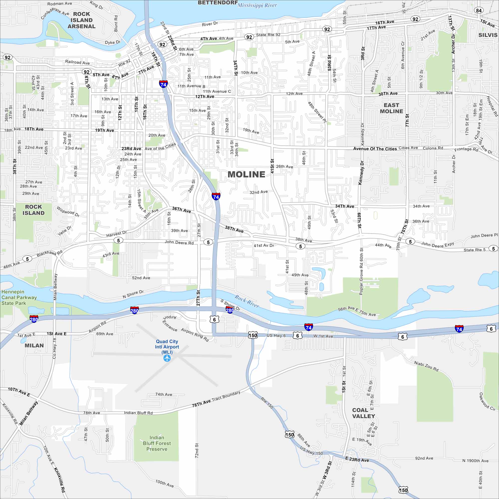
Check out our map of Moline, part of the Quad Cities. The Mississippi River defines its southern edge, while bridges connect it across state lines. It’s home to John Deere’s headquarters.
Illinois State Maps
Get to know Illinois with our state maps


Map Information
On the Map
Interstates/Highways: I-74, I-280, State Rte 92, State Rte 5, US Hwy 6, State Rte 150, State Rte 84 Major Roads: Avenue of the Cities, River Dr, 4th Ave, 7th Ave, 12th Ave, 16th Ave, 19th Ave, 23rd Ave, 36th Ave, 38th Ave, 41st St, 53rd St, 60th St, 70th St, Airport Rd, Indian Bluff Rd, Milan Beltway, Archer Dr, Colona Rd, Kennedy Dr Airports: Quad City Intl Airport (MLI) Major Rivers: Mississippi River, Rock River Parks and Preserves: Hennepin Canal Parkway State Park, Indian Bluff Forest Preserve Nearby Communities: Bettendorf, East Moline, Silvis, Coal Valley, Milan, Rock IslandIllinois City Maps
Explore Chicago and urban regions of Illinois


