Map of Mount Pleasant, South Carolina
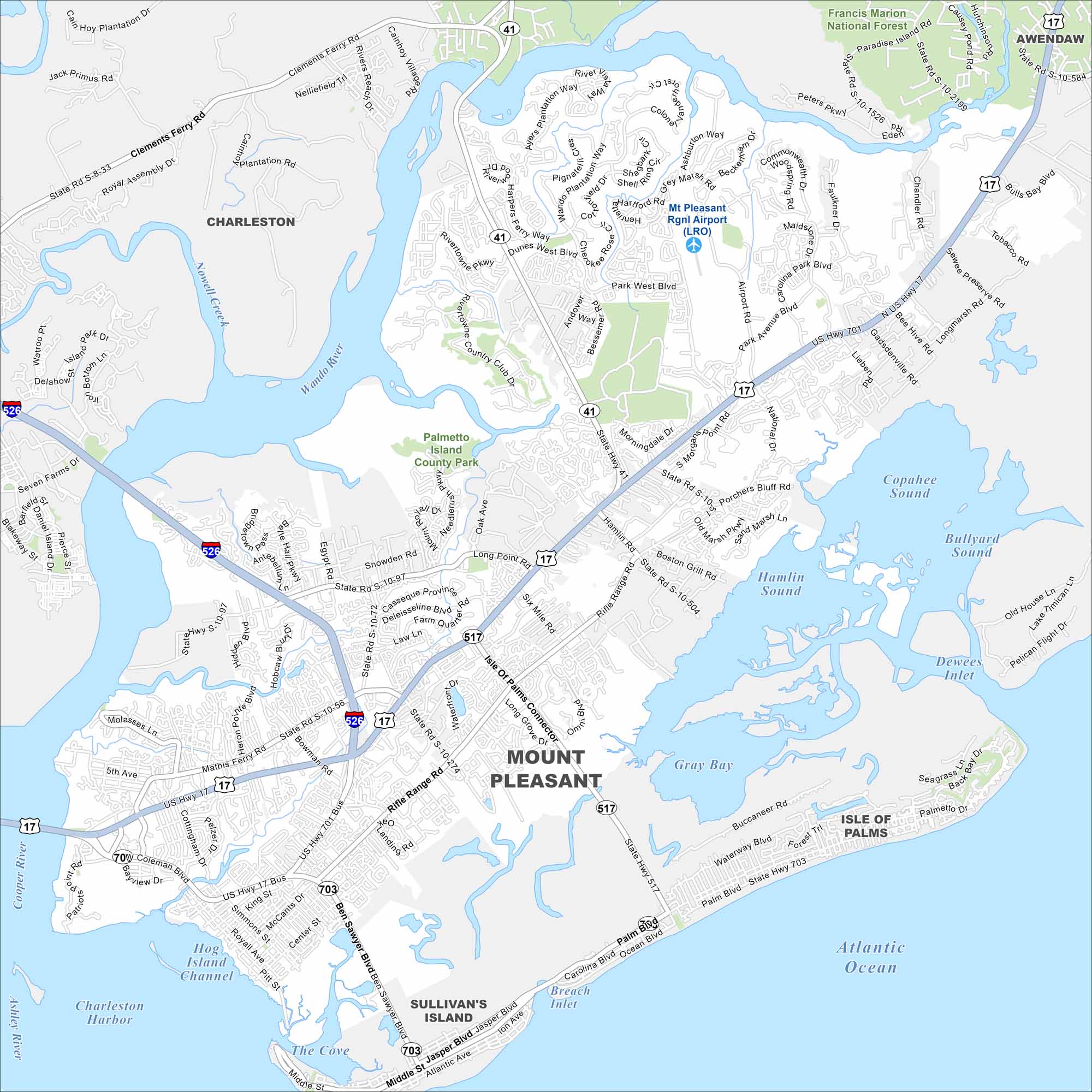
Our map of Mount Pleasant highlights its spot along Charleston Harbor. Bridges, waterways, and suburban neighborhoods define the city’s layout. It’s a key gateway to the beaches nearby.
Map Information
On the Map
Interstates/Highways: I-526, US Hwy 17, US Hwy 17 Bus, State Rte 41, State Rte 517, State Rte 703 Major Roads: Johnnie Dodds Blvd, Chuck Dawley Blvd, Coleman Blvd, Ben Sawyer Blvd, Rifle Range Rd, Isle of Palms Connector, Long Point Rd, Mathis Ferry Rd, Highway 41, Park West Blvd, Bessemer Rd, Rivertowne Pkwy, Dunes West Blvd, Seacoast Pkwy, Whipple Rd, Bowman Rd, Six Mile Rd, Porchers Bluff Rd, Hamlin Rd, Seven Farms Dr Airports: Mt Pleasant Rgnl Airport (LRO) Lakes and Reservoirs: Atlantic Ocean, Gray Bay, Hamlin Sound, Copahee Sound, Bullyard Sound, Dewees Inlet, Breach Inlet, Charleston Harbor, The Cove Major Rivers: Wando River, Cooper River, Ashley River, Nowell Creek Parks and Preserves: Palmetto Island County Park, Francis Marion National Forest Nearby Communities: Charleston, Awendaw, Sullivan’s Island, Isle of PalmsSouth Carolina State Maps
Explore maps across the Palmetto State.


City Maps of South Carolina
Find our maps of Charleston and South Carolina cities here


