Map of Mount Washington, Kentucky
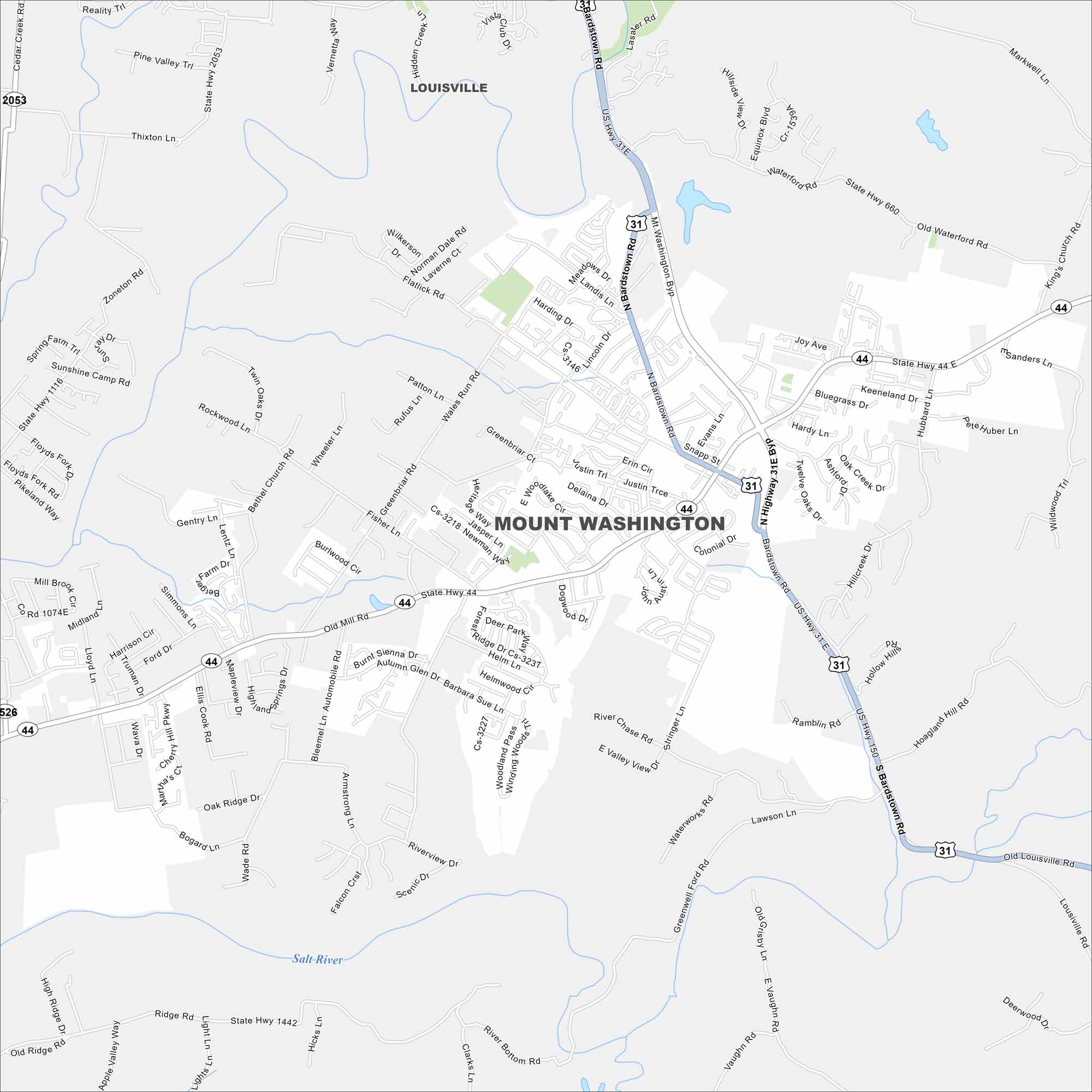
Our map of Mount Washington displays this growing suburb southeast of Louisville. Residential areas spread outward while highways link it to the metro. Growth here has been steady for decades.
Kentucky State Maps
Our Kentucky maps reveal the Bluegrass State


Map Information
On the Map
Interstates/Highways: US Hwy 31E, US Hwy 150, State Rte 44 Major Roads: Mt Washington Byp, N Bardstown Rd, S Bardstown Rd, Old Mill Rd, Landis Ln, Greenbriar Rd, Bogard Ln, Flatlick Rd, Fisher Ln, Slate Hwy 2053, Armstrong Ln, Whitener Ln, Heritage Way, Stonegate Dr, Oak Ridge Dr, Brookstone Way, Park Dr, Woodlake Ct, Snapp St, Colonial Dr Major Rivers: Salt River Nearby Communities: LouisvilleCity Maps of Kentucky
Here are Kentucky’s cities in full detail