Map of Myrtle Beach, South Carolina
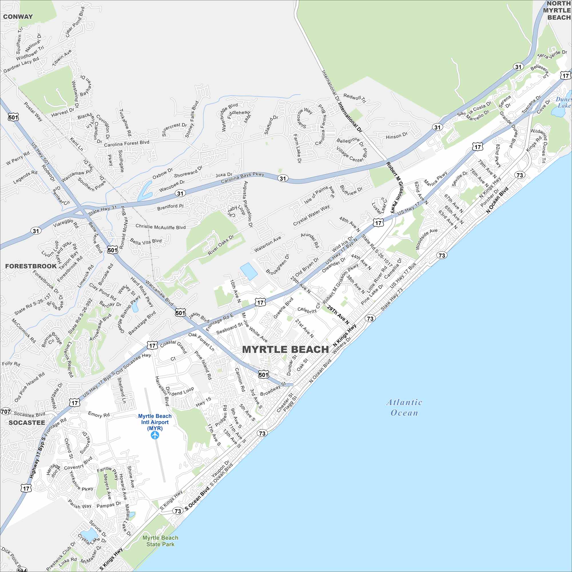
Our map of Myrtle Beach highlights a resort city on the Atlantic coast. A long beachfront, boardwalk, and golf courses dominate the layout. Tourism drives nearly everything here.
Map Information
On the Map
Interstates/Highways: US Hwy 501, US Hwy 17, State Rte 31, State Rte 707, State Rte 73 Major Roads: Kings Hwy, Ocean Blvd, Robert Grissom Pkwy, Farrow Pkwy, Harrelson Blvd, Carolina Forest Blvd, International Dr, Grissom Pkwy, 29th Ave, 38th Ave, 48th Ave, 62nd Ave, 79th Ave, 82nd Pkwy, Broadway St, Main St, 3rd Ave, 10th Ave, 17th Ave, 21st Ave Airports: Myrtle Beach Intl Airport (MYR) Lakes and Reservoirs: Atlantic Ocean, Dunes Lake Major Rivers: Waccamaw River Parks and Preserves: Myrtle Beach State Park Nearby Communities: Conway, North Myrtle Beach, Forestbrook, SocasteeSouth Carolina State Maps
Explore maps across the Palmetto State.


City Maps of South Carolina
Find our maps of Charleston and South Carolina cities here


