Map of Norfolk, Virginia
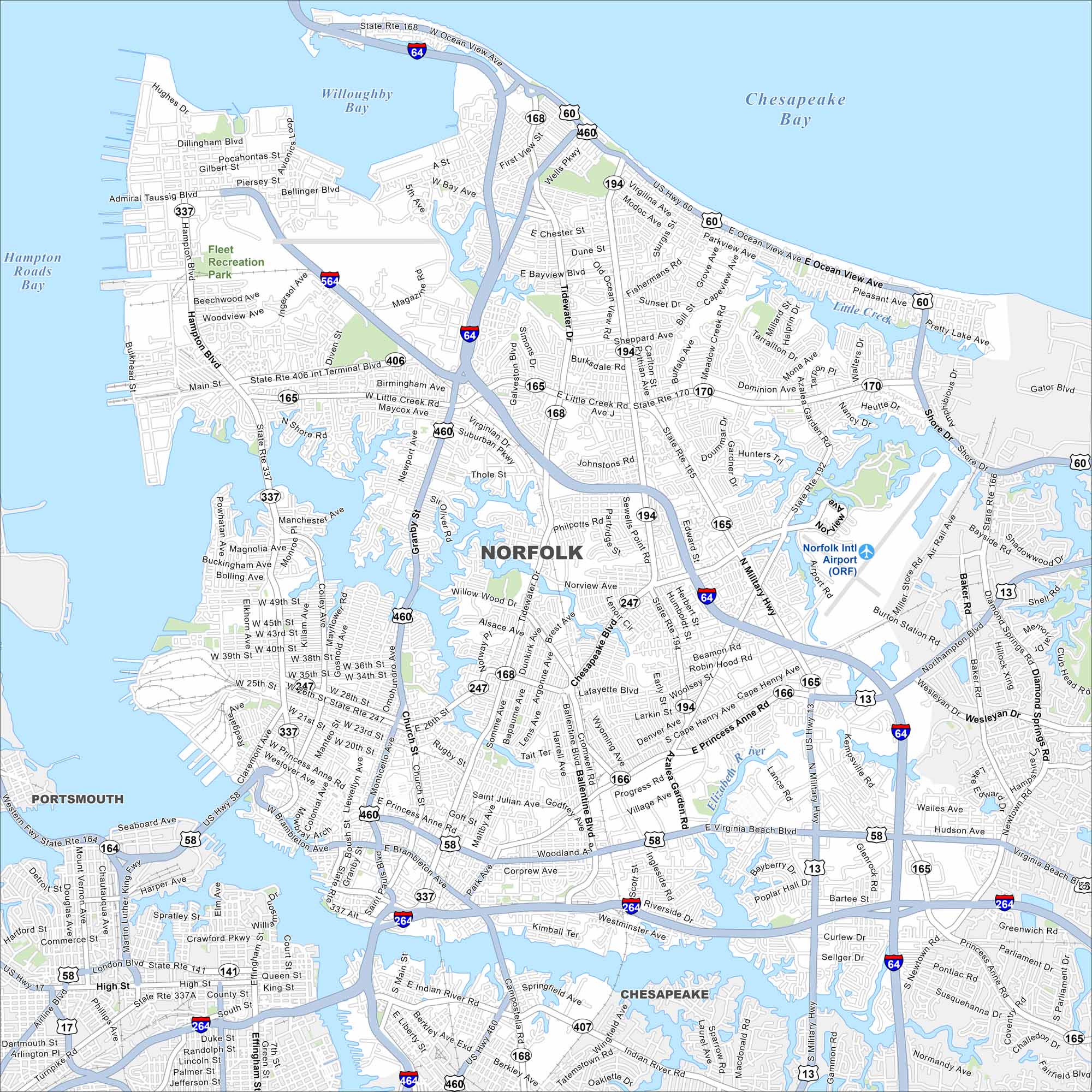
Norfolk sits at the mouth of the Chesapeake Bay. The map shows its road network, downtown streets, and a busy port. The city anchors the larger Hampton Roads metro.
Map Information
On the Map
Interstates/Highways: I-64, I-264, I-564, I-464, US Hwy 60, US Hwy 460, US Hwy 13, US Hwy 58, State Rte 168, State Rte 194, State Rte 406, State Rte 165, State Rte 170, State Rte 192, State Rte 247, State Rte 337, State Rte 166, State Rte 164, State Rte 141, State Rte 407 Major Roads: Military Hwy, Virginia Beach Blvd, Tidewater Dr, Little Creek Rd, Hampton Blvd, Granby St, Shore Dr, Monticello Ave, Princess Anne Rd, Brambleton Ave, Indian River Rd, Azalea Garden Rd, Northampton Blvd, Kempsville Rd, Newtown Rd, Main St, Ballentine Blvd, Colley Ave, Llewellyn Ave, Park Ave Airports: Norfolk Intl Airport (ORF) Lakes and Reservoirs: Willoughby Bay, Chesapeake Bay Major Rivers: Elizabeth River, Little Creek Parks and Preserves: Fleet Recreation Park Nearby Communities: Portsmouth, ChesapeakeVirginia State Maps
Spanning coasts and mountains, here are our maps of Virginia.


City Maps of Virginia
Traverse Virginia using our city maps


