Map of North Myrtle Beach, South Carolina
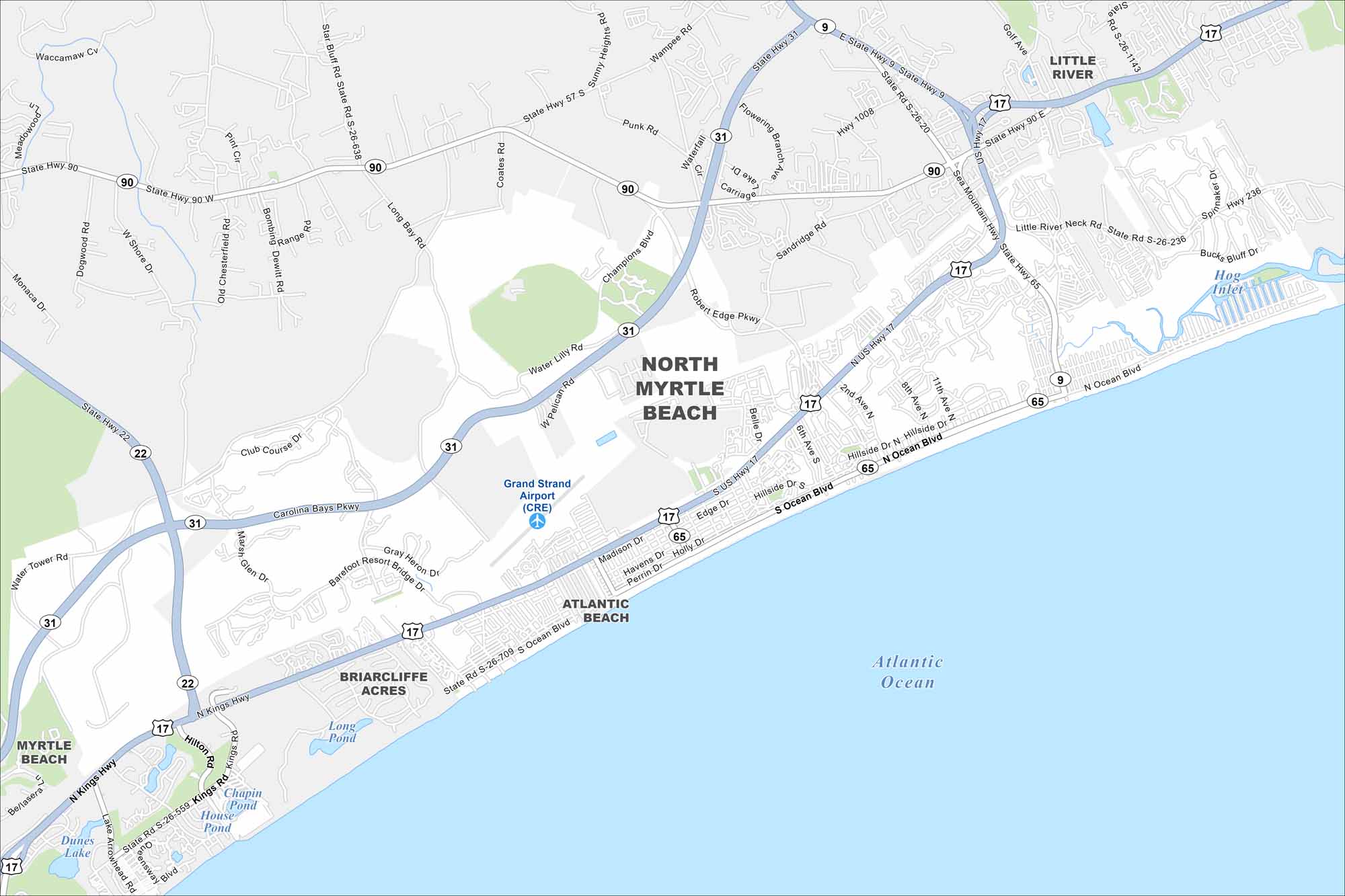
North Myrtle Beach lines the Atlantic coast just above Myrtle Beach. Take a look at the map to see beachfront neighborhoods and highways leading inland. Tourism drives much of the activity here.
Map Information
On the Map
Interstates/Highways: US Hwy 17, State Rte 9, State Rte 22, State Rte 31, State Rte 65, State Rte 90 Major Roads: Ocean Blvd, Sea Mountain Hwy, Robert Edge Pkwy, Little River Neck Rd, Kings Hwy, Water Lilly Rd, Champions Blvd, Long Bay Rd, Bombing Dewitt Rd, Old Chesterfield Rd, Dogwood Rd, Shore Dr, Nixonville Rd, Star Bluff Rd, Wampee Rd, Waterfall Cir, Carriage Ave, Sandridge Rd, Hillside Dr, Barefoot Resort Bridge Rd Airports: Grand Strand Airport (CRE) Lakes and Reservoirs: Atlantic Ocean, Long Pond, Chapin Pond, House Pond, Dunes Lake Nearby Communities: Little River, Atlantic Beach, Briarcliffe Acres, Myrtle BeachSouth Carolina State Maps
Explore maps across the Palmetto State.


City Maps of South Carolina
Find our maps of Charleston and South Carolina cities here


