Map of Ogden, Utah
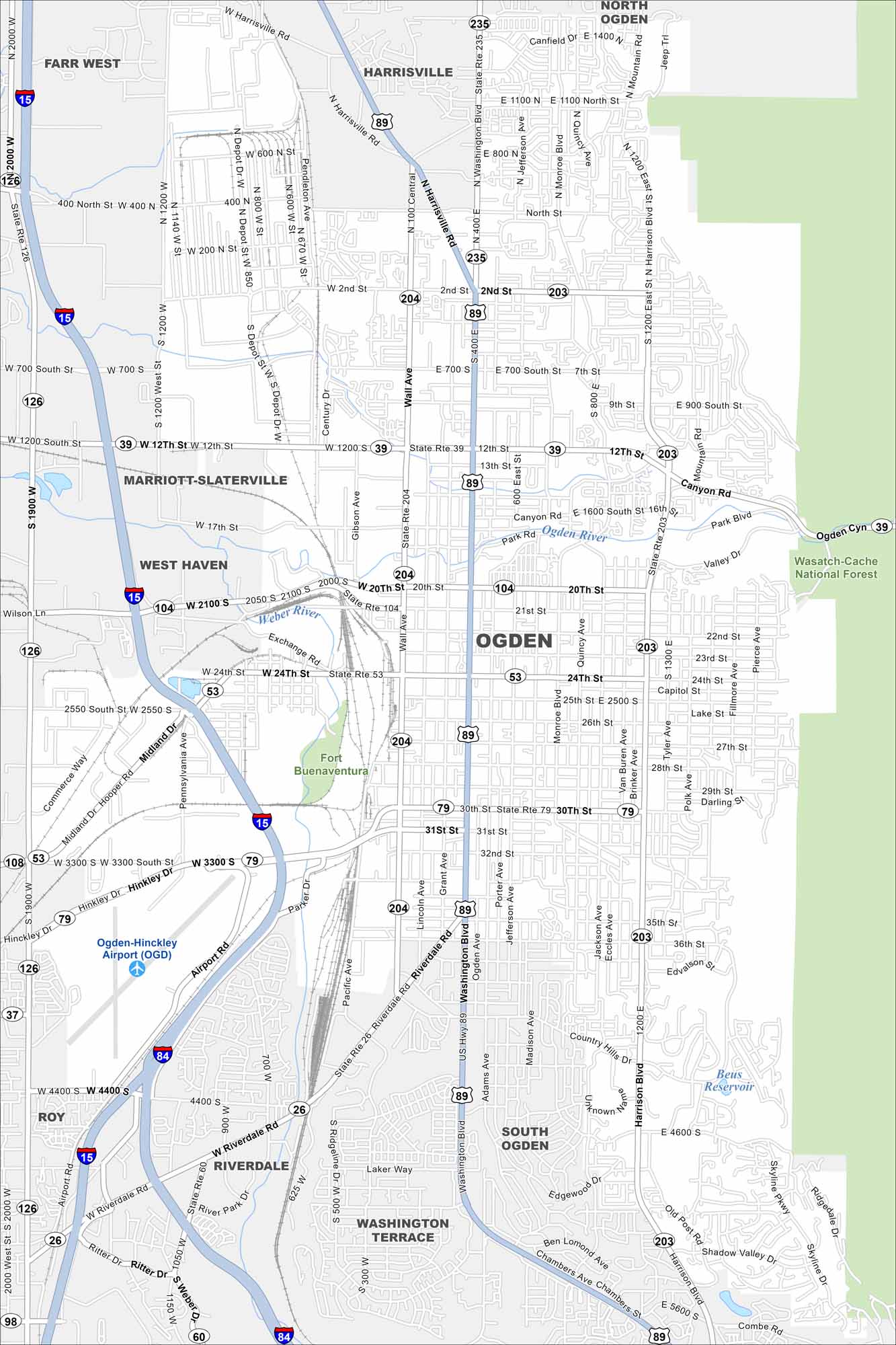
Our map of Ogden shows a city at the foot of the Wasatch Mountains. The downtown grid spreads toward the Great Salt Lake. Historic 25th Street is a standout landmark.
Map Information
On the Map
Interstates/Highways: I-15, I-84, US Hwy 89, State Rte 235, State Rte 204, State Rte 203, State Rte 39, State Rte 53, State Rte 79, State Rte 26, State Rte 60, State Rte 126 Major Roads: Washington Blvd, Harrison Blvd, Wall Ave, 12th St, 20th St, 24th St, 30th St, 31st St, 3300 South St, 36th St, 4400 South St, Riverdale Rd, Monroe Blvd, Grant Ave, Pennsylvania Ave, Midland Dr, Hinckley Dr, Skyline Dr, Adams Ave, Park Rd Airports: Ogden-Hinckley Airport Lakes and Reservoirs: Beus Reservoir Major Rivers: Ogden River, Weber River Parks and Preserves: Fort Buenaventura, Wasatch-Cache National Forest Nearby Communities: North Ogden, Harrisville, Farr West, Marriott-Slaterville, West Haven, Roy, Riverdale, South Ogden, Washington TerraceUtah State Maps
Look through maps of deserts, parks, and cities.


City Maps of Utah
Here is Salt Lake City and Utah’s urban regions.


