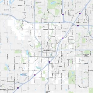
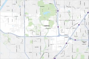
Map of Olathe, Kansas
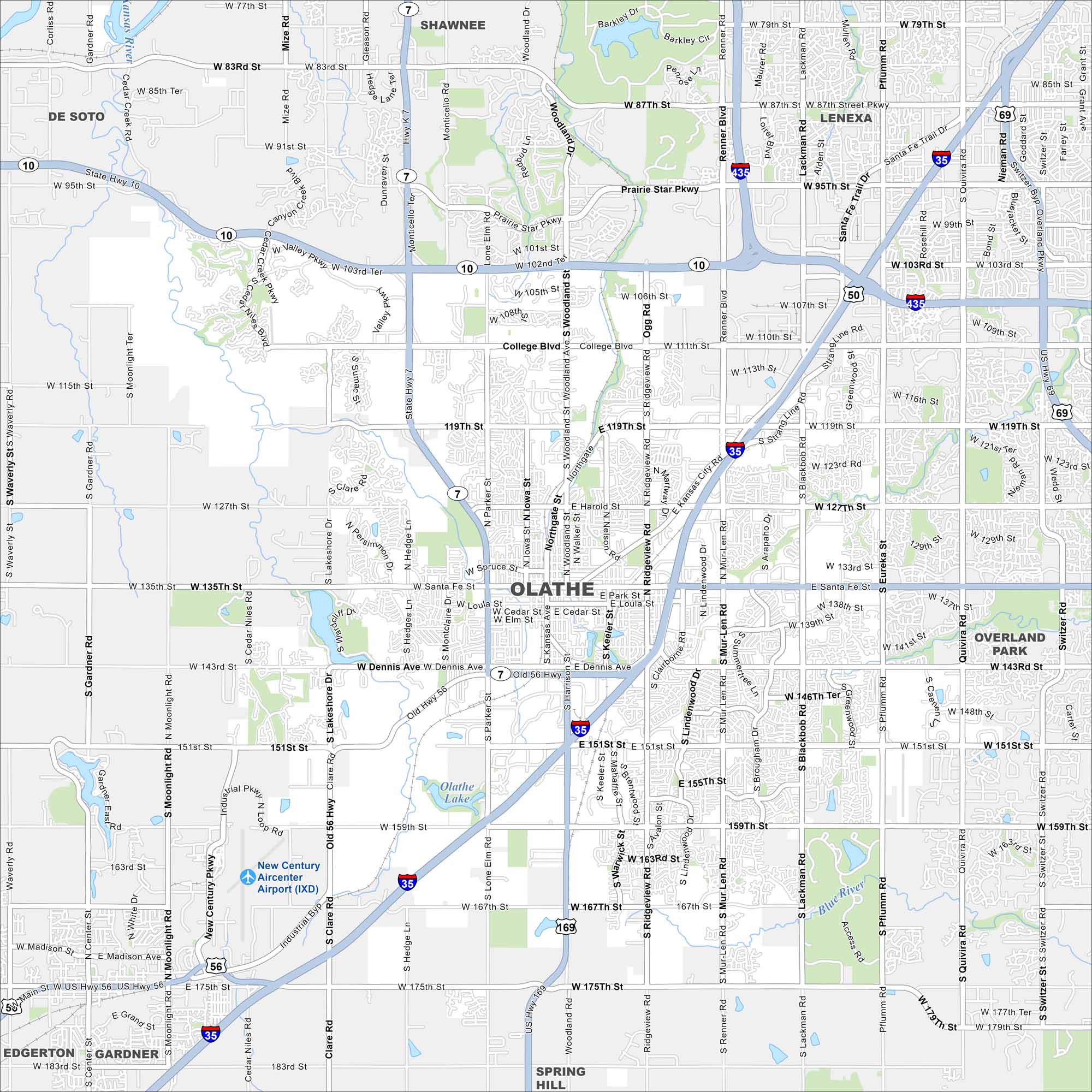
Olathe lies southwest of Kansas City spreading across rolling prairie. Our map highlights highways, lakes, rivers and greenbelts. Growth has made it one of the largest cities in the state.
Kansas State Maps
Explore every corner of Kansas with our state maps


Map Information
On the Map
Interstates/Highways: I-35, US Hwy 169, US Hwy 56, State Hwy 7, State Hwy 10 Major Roads: Santa Fe St, 119th St, 135th St, 151st St, College Blvd, 127th St, 159th St, 167th St, 175th St, Ridgeview Rd, Woodland St, Mur-Len Rd, Blackbob Rd, Pflumm Rd, Quivira Rd, Parker St, Lone Elm Rd, Clare Rd, Lakeshore Dr, Kansas City Rd Airports: New Century Aircenter Airport (IXD) Lakes and Reservoirs: Olathe Lake Major Rivers: Kansas River, Blue River Nearby Communities: Lenexa, Shawnee, Overland Park, De Soto, Edgerton, Gardner, Spring HillCity Maps of Kansas
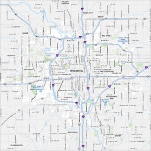
See our maps of Wichita and other urban centers