Map of Palatine, Illinois
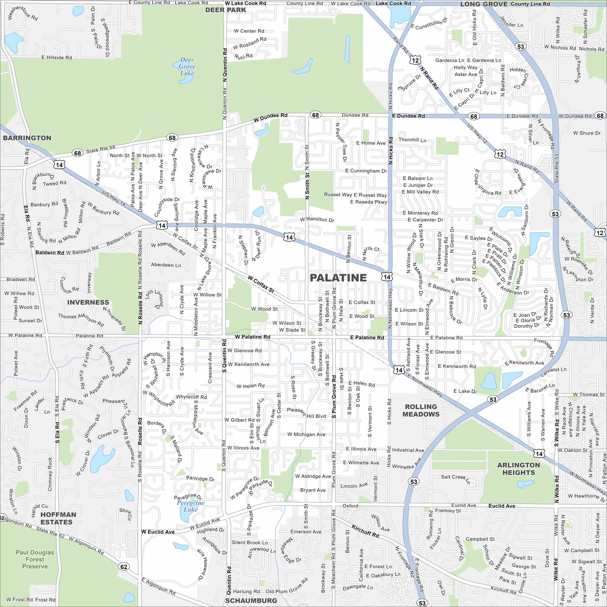
Get to know Palatine, northwest of Chicago. This map highlights its suburban grid, parks, lakes and waterways. It’s a large community with easy access to the metro area.
Illinois State Maps
Get to know Illinois with our state maps


Map Information
On the Map
Interstates/Highways: State Rte 68, US Hwy 14, US Hwy 12, State Rte 53, State Rte 62, Northwest Hwy Major Roads: Dundee Rd, Palatine Rd, Quentin Rd, Roselle Rd, Euclid Ave, Hicks Rd, Algonquin Rd, Smith St, Plum Grove Rd, Wilke Rd, Baldwin Rd, Colfax St, Illinois Ave, Cunningham Dr, Winston Dr, Rohlwing Rd, Kirchoff Rd, Lake Cook Rd Lakes and Reservoirs: Deer Grove Lake, Loch Lomond, Peregrine Lake Parks and Preserves: Paul Douglas Forest Preserve Nearby Communities: Barrington, Deer Park, Long Grove, Inverness, Rolling Meadows, Arlington Heights, Hoffman Estates, SchaumburgIllinois City Maps
Explore Chicago and urban regions of Illinois


