Map of Payson, Utah
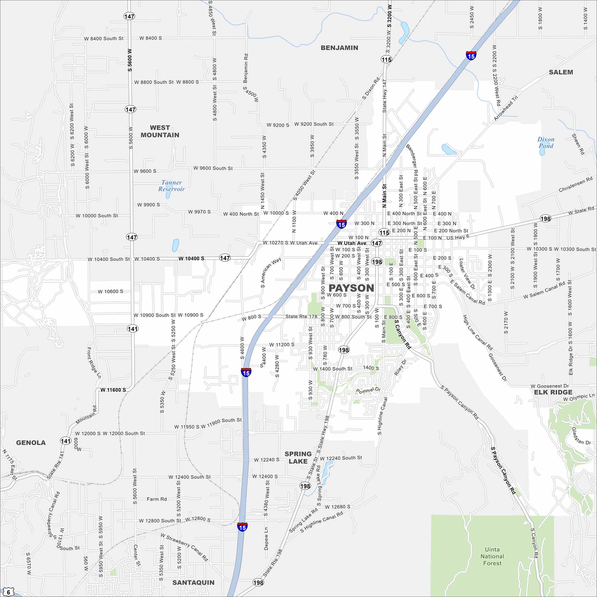
Payson rests against the foothills of the Wasatch Range. Our map points out its downtown area and nearby Nebo Loop scenic drive. The mountains frame the city beautifully.
Map Information
On the Map
Interstates/Highways: I-15, State Rte 147, State Rte 198, State Rte 141 Major Roads: Main St, Utah Ave, 100 North St, 400 North St, 800 South St, 11200 South St, 12400 South St, 4600 West St, 5600 West St, 800 West St, 600 East St, 800 East St, Salem Canal Rd, Canyon Rd, Arrowhead Trl, 9200 South St, 9600 South St, 10000 South St, 10400 South St, 10900 South St Lakes and Reservoirs: Tanner Reservoir, Dixon Pond Parks and Preserves: Uinta National Forest Nearby Communities: Benjamin, Salem, Elk Ridge, Spring Lake, Santaquin, Genola, West MountainUtah State Maps
Look through maps of deserts, parks, and cities.


City Maps of Utah
Here is Salt Lake City and Utah’s urban regions.


