Map of Petersburg, Virginia
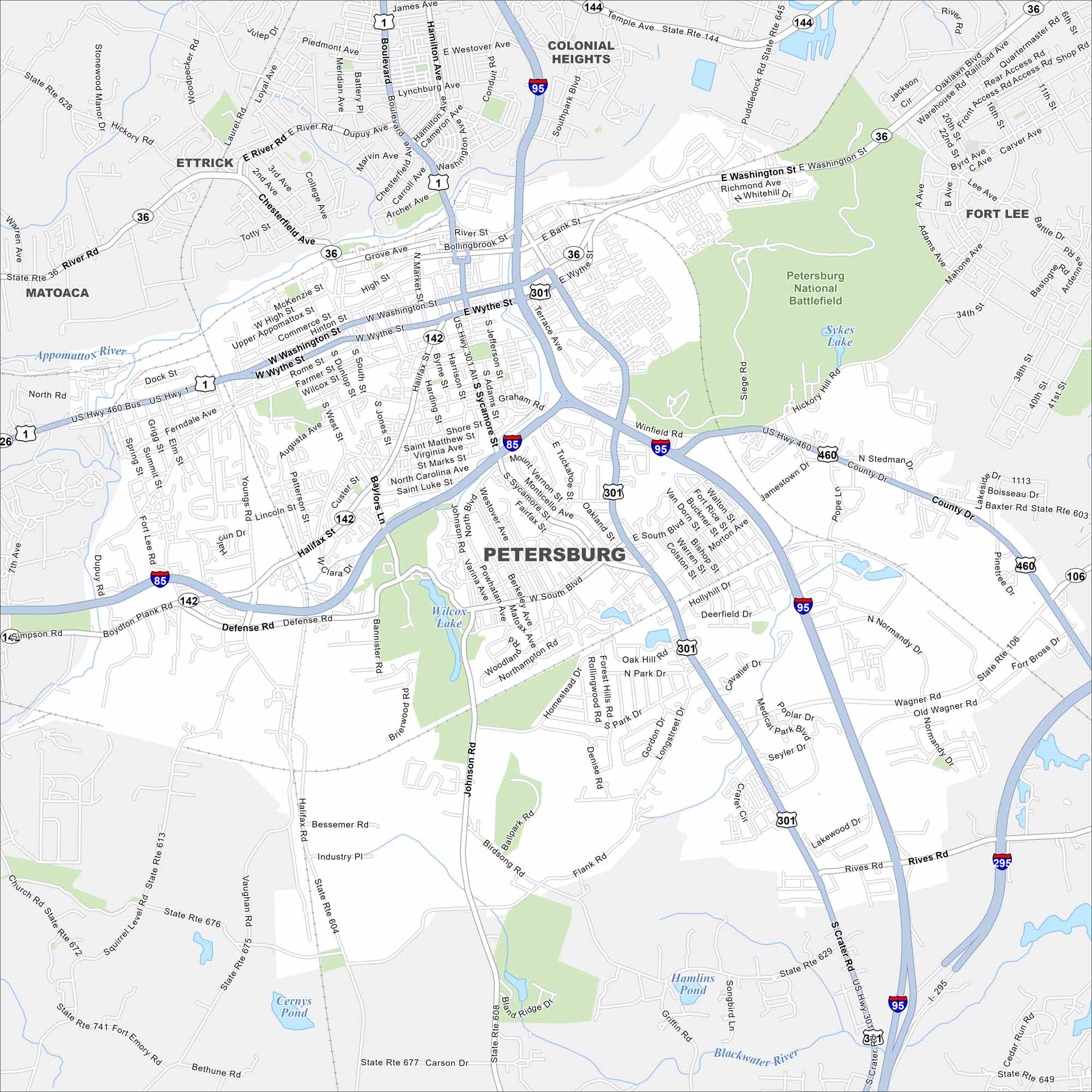
Our map of Petersburg shows a city shaped by the Appomattox River. Its historic district stands out with Civil War sites and old brick buildings. Petersburg National Battlefield is one of them in the east side of the city.
Map Information
On the Map
Interstates/Highways: I-95, I-85, I-295, US Hwy 460, US Hwy 1, US Hwy 301, State Rte 36, State Rte 142, State Rte 144, State Rte 604, State Rte 613, State Rte 672, State Rte 675, State Rte 676, State Rte 677, State Rte 741 Major Roads: Washington St, Wythe St, Crater Rd, South Blvd, Graham Rd, Halifax St, Wagner Rd, Boydton Plank Rd, Defense Rd, Johnson Rd, Flank Rd, Hickory Hill Rd, Winfield Rd, Siege Rd, Dupuy Ave, River Rd, Conduit Ave, Puddledock Rd, Rives Rd, Birdsong Rd Lakes and Reservoirs: Sykes Lake, Wilcox Lake, Cernys Pond, Hamlins Pond Major Rivers: Appomattox River, Blackwater River Parks and Preserves: Petersburg National Battlefield Nearby Communities: Colonial Heights, Ettrick, Matoaca, Fort LeeVirginia State Maps
Spanning coasts and mountains, here are our maps of Virginia.


City Maps of Virginia
Traverse Virginia using our city maps


