Map of Riverton, Utah
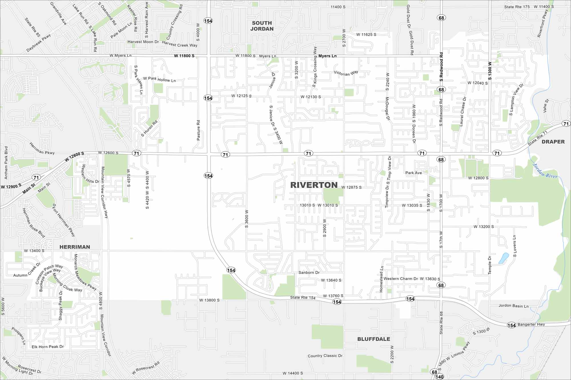
Our map of Riverton displays major parks and local roads. This city that’s part of the Salt Lake County region is known for its exceptional school system and recreational areas.
Map Information
On the Map
Interstates/Highways: State Rte 154, State Rte 71, State Rte 68, State Rte 85, State Rte 175 Major Roads: Bangerter Hwy, Redwood Rd, Mountain View Corridor Hwy, Main St, 12600 S, 13400 S, 11400 S, 11800 S, 13800 S, 14400 S, Riverfront Pkwy, Daybreak Pkwy, Herriman Pkwy, 2700 W, 3600 W, 4000 S, 1300 W, 1700 W, 2200 W, Teton Estates Dr Major Rivers: Jordan River Nearby Communities: Riverton, Herriman, South Jordan, Bluffdale, DraperUtah State Maps
Look through maps of deserts, parks, and cities.


City Maps of Utah
Here is Salt Lake City and Utah’s urban regions.


