Map of Rock Hill, South Carolina
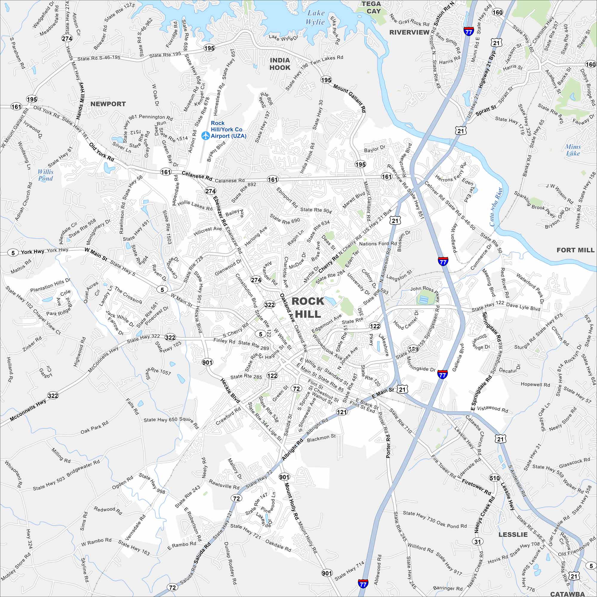
Our map of Rock Hill shows the downtown blocks and the routes running north toward Charlotte. Lake Wylie sits in the north of the city, a man-made reservoir.
Map Information
On the Map
Interstates/Highways: I-77, US Hwy 21, State Rte 5, State Rte 31, State Rte 72, State Rte 121, State Rte 122, State Rte 161, State Rte 274, State Rte 322, State Rte 447, State Rte 510, State Rte 901 Major Roads: Celanese Rd, Cherry Rd, Dave Lyle Blvd, Anderson Rd, Main St, Albright Rd, Heckle Blvd, Saluda Rd, Mount Holly Rd, India Hook Rd, Mount Gallant Rd, Ebinport Rd, Constitution Blvd, Oakland Ave, Standard St, Black St, Eden Terrace, Firetower Rd, Neelys Creek Rd, Porter Rd Airports: Rock Hill/York Co Airport (UZA) Lakes and Reservoirs: Lake Wylie, Willis Pond, Mims Lake Major Rivers: Catawba River Nearby Communities: Newport, India Hook, Tega Cay, Riverview, Fort Mill, Lesslie, CatawbaSouth Carolina State Maps
Explore maps across the Palmetto State.


City Maps of South Carolina
Find our maps of Charleston and South Carolina cities here


