Map of Romeoville, Illinois
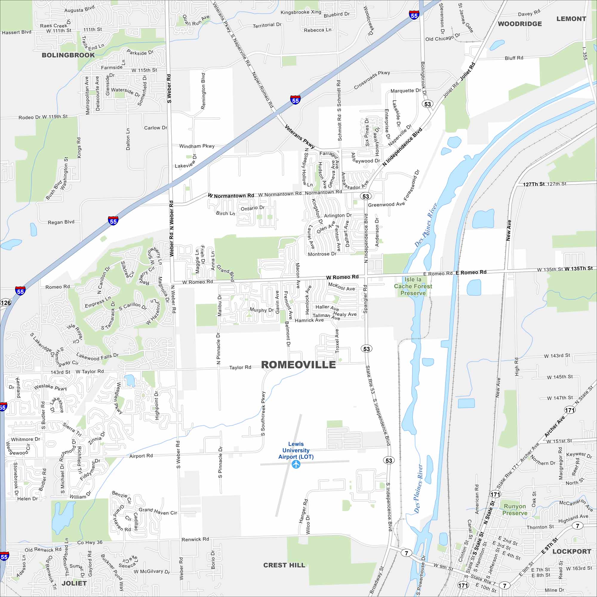
Our map of Romeoville shows local streets, parks, and business districts. It also highlights quick routes into Chicago. You’ll see exactly how to move through the area.
Illinois State Maps
Get to know Illinois with our state maps


Map Information
On the Map
Interstates/Highways: I-55, I-355, State Rte 53, State Rte 7, State Rte 126, State Rte 171 Major Roads: Independence Blvd, Weber Rd, Romeo Rd, Taylor Rd, Normantown Rd, Renwick Rd, Airport Rd, Veterans Pkwy, Naperville Rd, Schmidt Rd, Joliet Rd, 135th St, Archer Ave, New Ave, 143rd St, 147th St, 151st St, Division St, State St, Broadway St Airports: Lewis University Airport (LOT) Major Rivers: Des Plaines River Parks and Preserves: Isle la Cache Forest Preserve, Runyon Preserve Nearby Communities: Bolingbrook, Woodridge, Lemont, Lockport, Crest Hill, JolietIllinois City Maps
Explore Chicago and urban regions of Illinois


