Map of Saratoga Springs, Utah
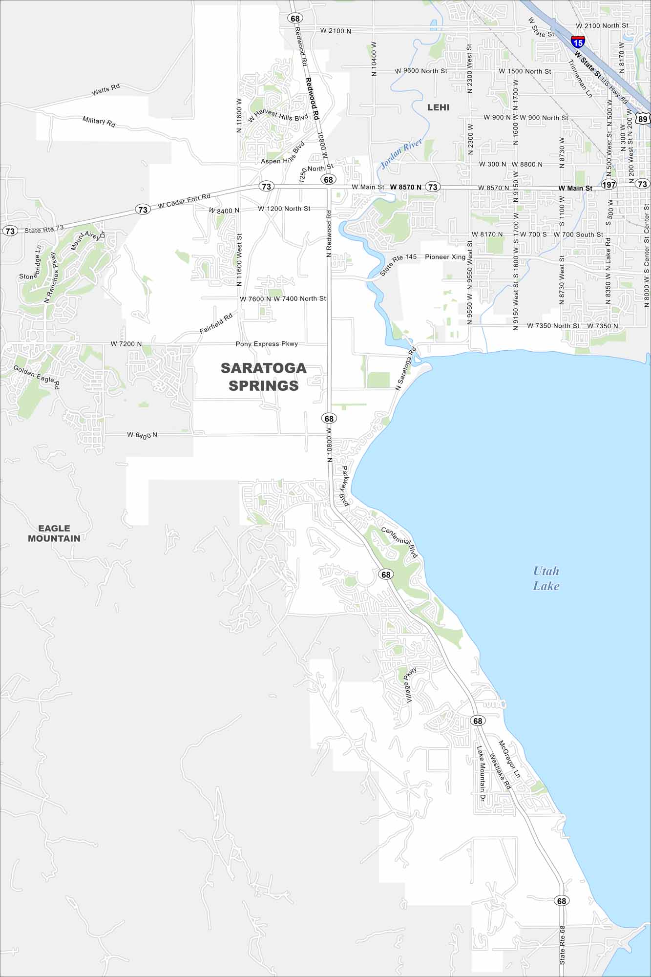
Take a look at our map of Saratoga Springs. It highlights the neighborhoods along Utah Lake and Jordan River. You’ll also find the main roads into the valley.
Map Information
On the Map
Interstates/Highways: State Rte 68, State Rte 73, State Rte 145, State Rte 197, US Hwy 89, I-15 Major Roads: Redwood Rd, Main St, Pony Express Pkwy, 2100 N, Pioneer Xing, Centennial Blvd, Village Pkwy, Lake Mountain Dr, Foothill Blvd, Grandville Ave, 2300 W, 1200 N, 8000 N, 7350 N, 9550 W, 8350 W, Trinnaman Ln, Harvest Hills Blvd, Aspen Hills Blvd, Fairfield Rd Lakes and Reservoirs: Utah Lake Major Rivers: Jordan River Nearby Communities: Lehi, Eagle MountainUtah State Maps
Look through maps of deserts, parks, and cities.


City Maps of Utah
Here is Salt Lake City and Utah’s urban regions.


