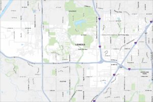
Map of Shawnee, Kansas
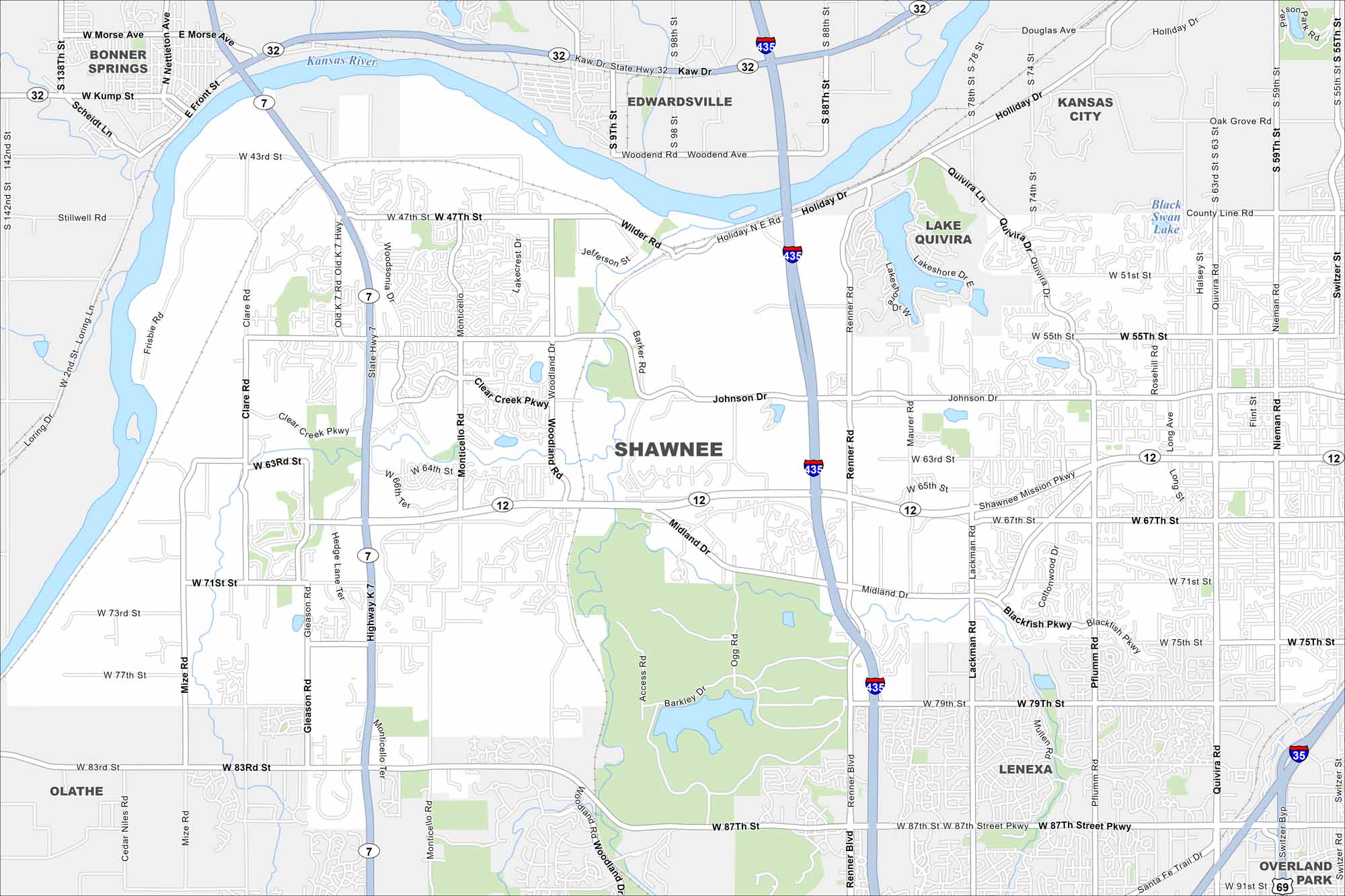
Our map of Shawnee shows you around this thriving Kansas City suburb. With parks, trails, and a growing downtown, there’s a lot to explore. The Kansas River also meanders through the north.
Kansas State Maps
Explore every corner of Kansas with our state maps


Map Information
On the Map
Interstates/Highways: I-435, I-35, US Hwy 69, State Hwy 7, State Hwy 12, State Hwy 32 Major Roads: Shawnee Mission Pkwy, Johnson Dr, 75th St, 63rd St, 47th St, 87th St, Pflumm Rd, Quivira Rd, Maurer Rd, Renner Blvd, Lackman Rd, Monticello Rd, Woodland Dr, Blackfish Pkwy, Midland Dr, 71st St, 55th St, Kaw Dr, Holiday Dr, Nieman Rd Lakes and Reservoirs: Black Swan Lake Major Rivers: Kansas River Nearby Communities: Lenexa, Olathe, Bonner Springs, Edwardsville, Kansas City, Overland ParkCity Maps of Kansas
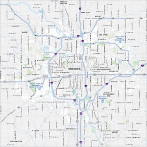
See our maps of Wichita and other urban centers