Map of Shiloh, Illinois
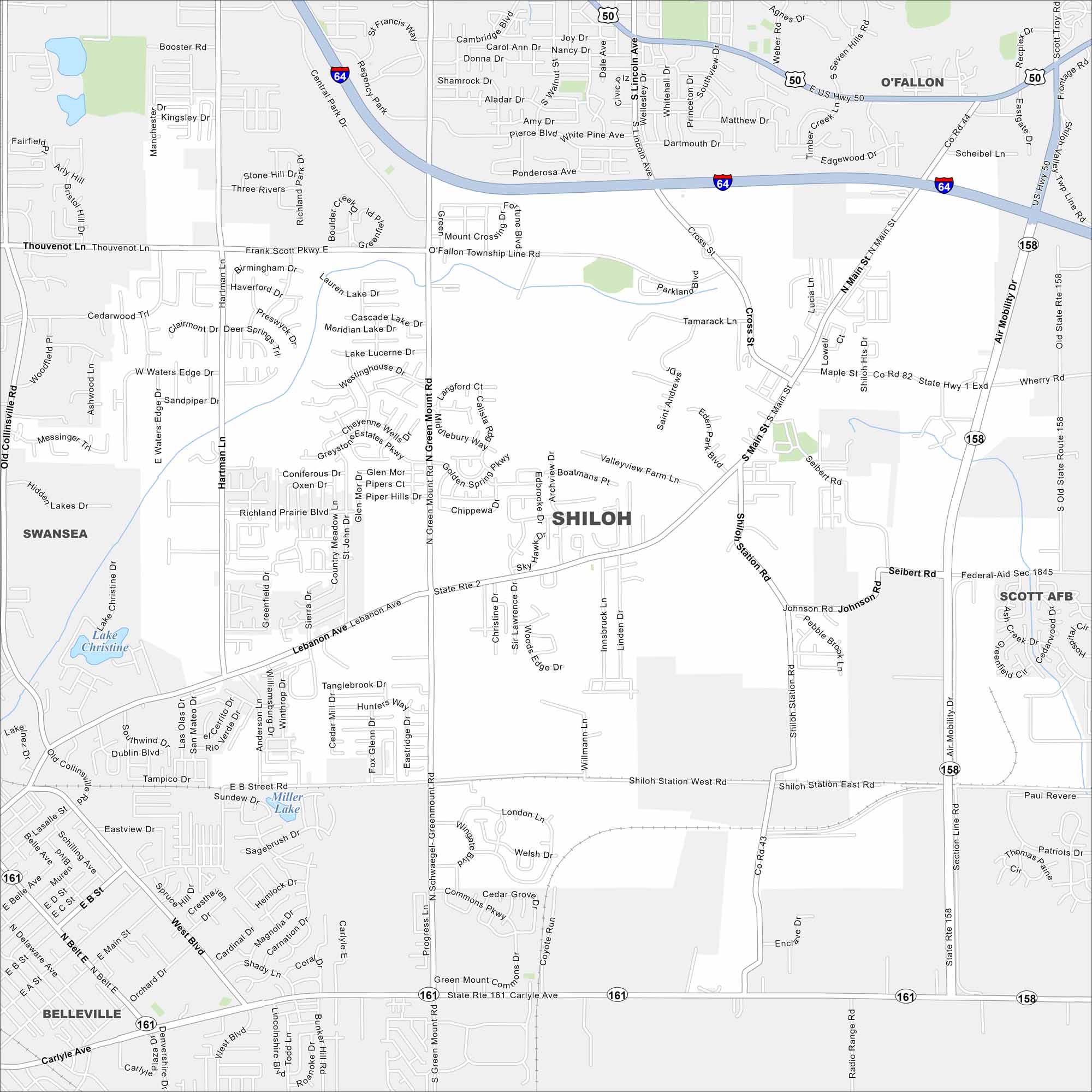
This street map of Shiloh helps you explore this town in St. Clair County, Illinois. It sits near Scott Air Force Base and has parks, schools, and shops.
Illinois State Maps
Get to know Illinois with our state maps


Map Information
On the Map
Interstates/Highways: I-64, US Hwy 50, State Rte 158, State Rte 161 Major Roads: Green Mount Rd, Air Mobility Dr, Shiloh Station Rd, Lebanon Ave, Main St, Central Park Dr, Frank Scott Pkwy, Hartman Ln, Seibert Rd, Johnson Rd, Cross St, Carlyle Ave, Fortune Blvd, Old Collinsville Rd Lakes and Reservoirs: Lake Christine, Miller Lake Nearby Communities: O’Fallon, Scott AFB, Belleville, SwanseaIllinois City Maps
Explore Chicago and urban regions of Illinois


