Map of Springfield, Illinois
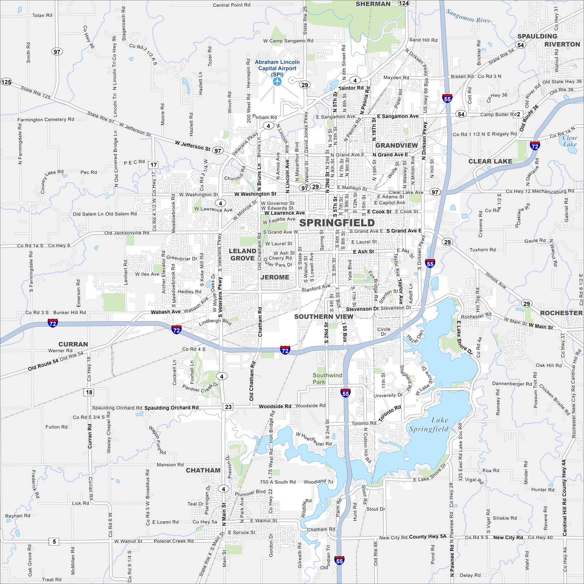
Get around Springfield with our map. As Illinois’ capital, the city is filled with Lincoln landmarks, government buildings and historic sites.
Illinois State Maps
Get to know Illinois with our state maps


Map Information
On the Map
Interstates/Highways: I-55, I-72, US Hwy 36, State Rte 29, State Rte 97, State Rte 4, State Rte 54, State Rte 125 Major Roads: Jefferson St, Grand Ave, Wabash Ave, Veterans Pkwy, Dirksen Pkwy, Sangamon Ave, Madison St, Cook St, Clear Lake Ave, Chatham Rd, MacArthur Blvd, Koke Mill Rd, Archer Elevator Rd, Toronto Rd, Woodside Rd, 9th St, 11th St, 19th St, Walnut St, Peoria Rd Airports: Abraham Lincoln Capital Airport (SPI) Lakes and Reservoirs: Lake Springfield, Clear Lake Major Rivers: Sangamon River Nearby Communities: Sherman, Spaulding, Riverton, Grandview, Leland Grove, Jerome, Southern View, Chatham, Curran, RochesterIllinois City Maps
Explore Chicago and urban regions of Illinois


