Map of Springfield, Missouri
Our Springfield Missouri map highlights a city often called the “Queen City of the Ozarks”. Downtown streets, parks, and nearby caves make it stand out.
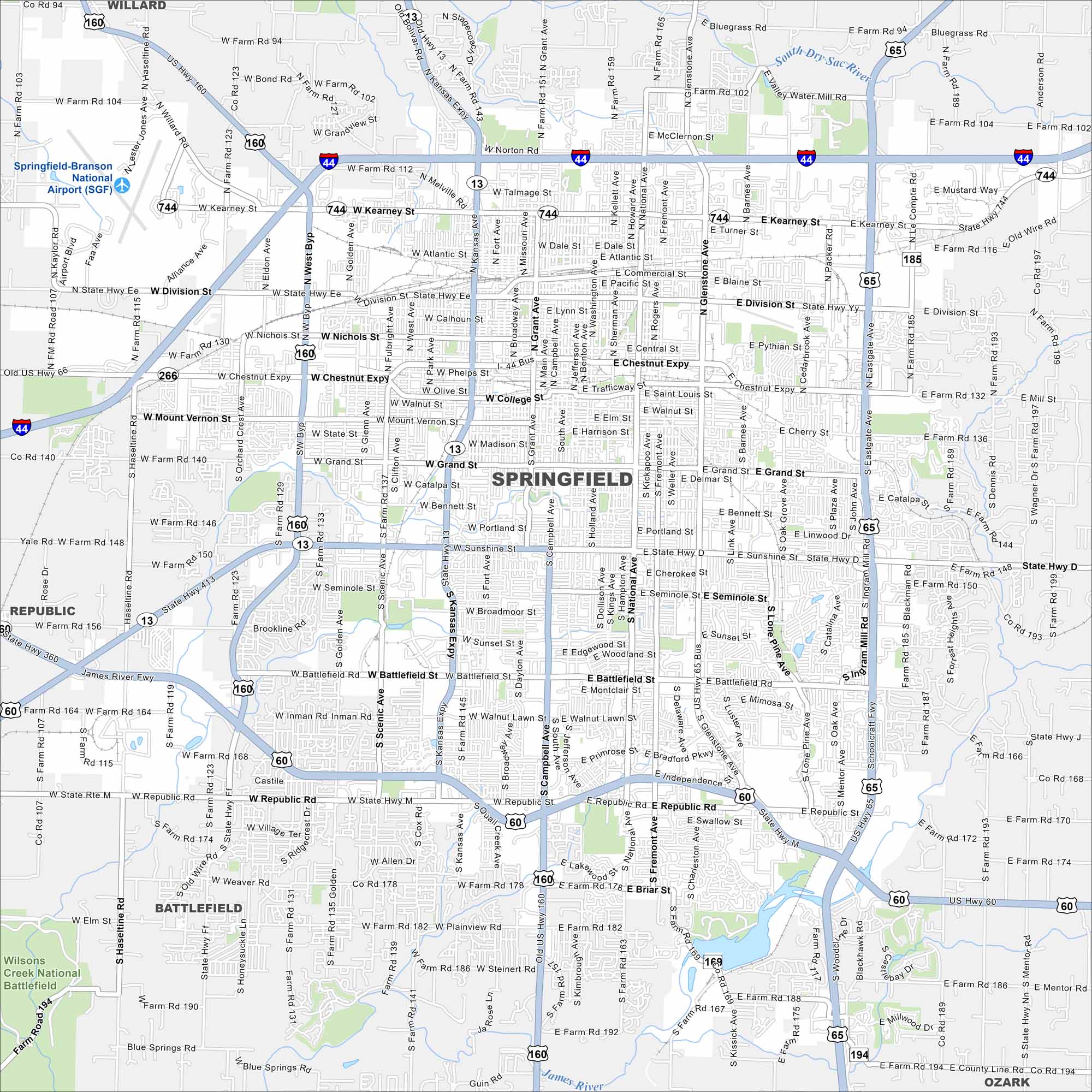
Map Information
On the Map
Interstates/Highways: I-44, US Hwy 60, US Hwy 65, US Hwy 160, State Hwy 13, State Hwy 121, State Hwy 266, State Hwy 413, State Hwy 744 Major Roads: Sunshine St, Glenstone Ave, Battlefield Rd, Kearney St, Chestnut Expy, Division St, Campbell Ave, National Ave, Kansas Expy, Republic Rd, West Byp, Main Ave, Grant Ave, Kansas Ave, West Ave, Scenic Ave, Golden Ave, Fort Ave, Kimbrough Ave, Jefferson Ave Airports: Springfield-Branson National Airport (SGF) Major Rivers: James River, South Dry Sac River Parks and Preserves: Wilsons Creek National Battlefield Nearby Communities: Willard, Republic, Battlefield, OzarkMissouri State Maps
Check out state maps of the Show-Me State.


Missouri City Maps
Here are our city maps for Missouri


