Map of Suffolk, Virginia
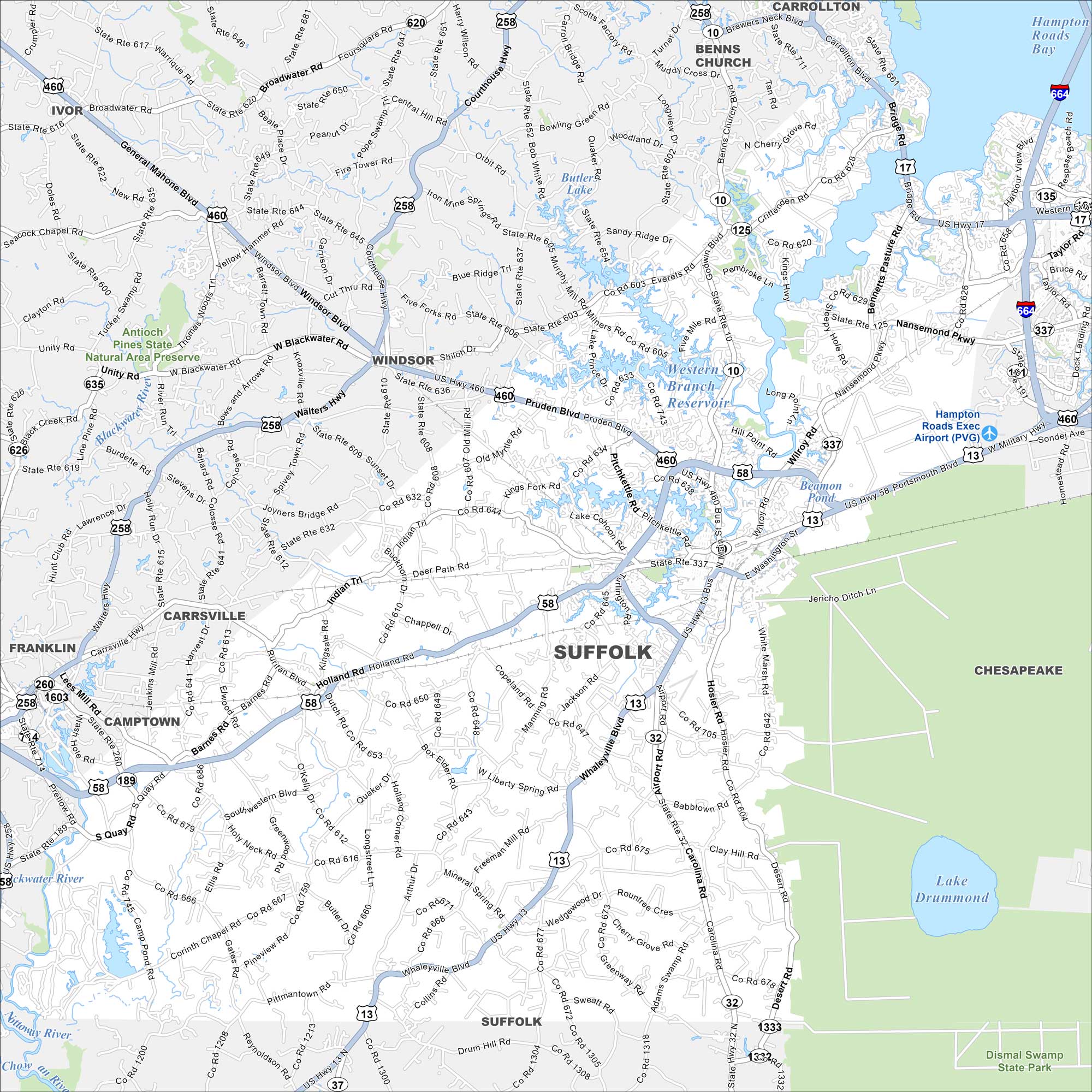
Our map of Suffolk shows the largest city in Virginia by land. You’ll find rivers, highways, farmland, and a growing downtown area.
Map Information
On the Map
Interstates/Highways: I-664, US Hwy 17, US Hwy 58, US Hwy 258, US Hwy 460, State Rte 10, State Rte 32, State Rte 125, State Rte 135, State Rte 189, State Rte 337 Major Roads: Holland Rd, Whaleyville Blvd, Carolina Rd, Portsmouth Blvd, Nansemond Pkwy, Bridge Rd, Godwin Blvd, Pruden Blvd, Wilroy Rd, Manning Rd, White Marsh Rd, Desert Rd, Pitchkettle Rd, Lake Cohoon Rd, Southwestern Blvd, Quaker Dr, Mineral Spring Rd, Kings Hwy, Crittenden Rd, Chuckatuck Rd Airports: Hampton Roads Exec Airport (PVG) Lakes and Reservoirs: Lake Drummond, Butler Lake, Hampton Roads Bay Major Rivers: Blackwater River, Nottoway River Parks and Preserves: Antioch Pines State Natural Area Preserve Nearby Communities: Windsor, Carrsville, Franklin, Benns Church, CarrolltonVirginia State Maps
Spanning coasts and mountains, here are our maps of Virginia.


City Maps of Virginia
Traverse Virginia using our city maps


