Map of Summerville, South Carolina
Here’s our map of Summerville, known as the Flowertown in the Pines. Azaleas bloom here every spring across shaded streets and gardens.
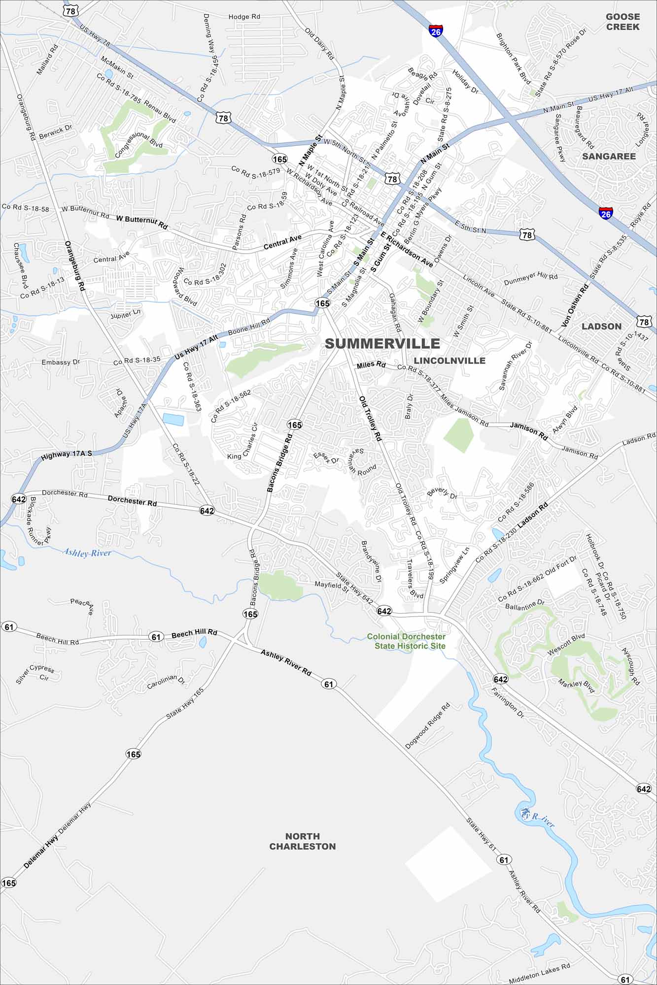
Map Information
On the Map
Interstates/Highways: I-26, US Hwy 17 Alt, US Hwy 78, State Rte 61, State Rte 165, State Rte 642 Major Roads: Main St, Berlin G Myers Pkwy, Old Trolley Rd, Dorchester Rd, Bacons Bridge Rd, Central Ave, Richardson Ave, Doty Ave, 5th North St, Maple St, Gahagan Rd, Miles Rd, Ladson Rd, Orangeburg Rd, Butternut Rd, Boone Hill Rd, Beech Hill Rd, Ashley River Rd, Brandywine Blvd, Travelers Blvd Lakes and Reservoirs: Ashley River Parks and Preserves: Colonial Dorchester State Historic Site Nearby Communities: Goose Creek, Sangaree, Lincolnville, Ladson, North CharlestonSouth Carolina State Maps
Explore maps across the Palmetto State.


City Maps of South Carolina
Find our maps of Charleston and South Carolina cities here


