Home » Tourist Maps » Cincinnati International Airport Map

Cincinnati International Airport Map

Cincinnati International Airport Map

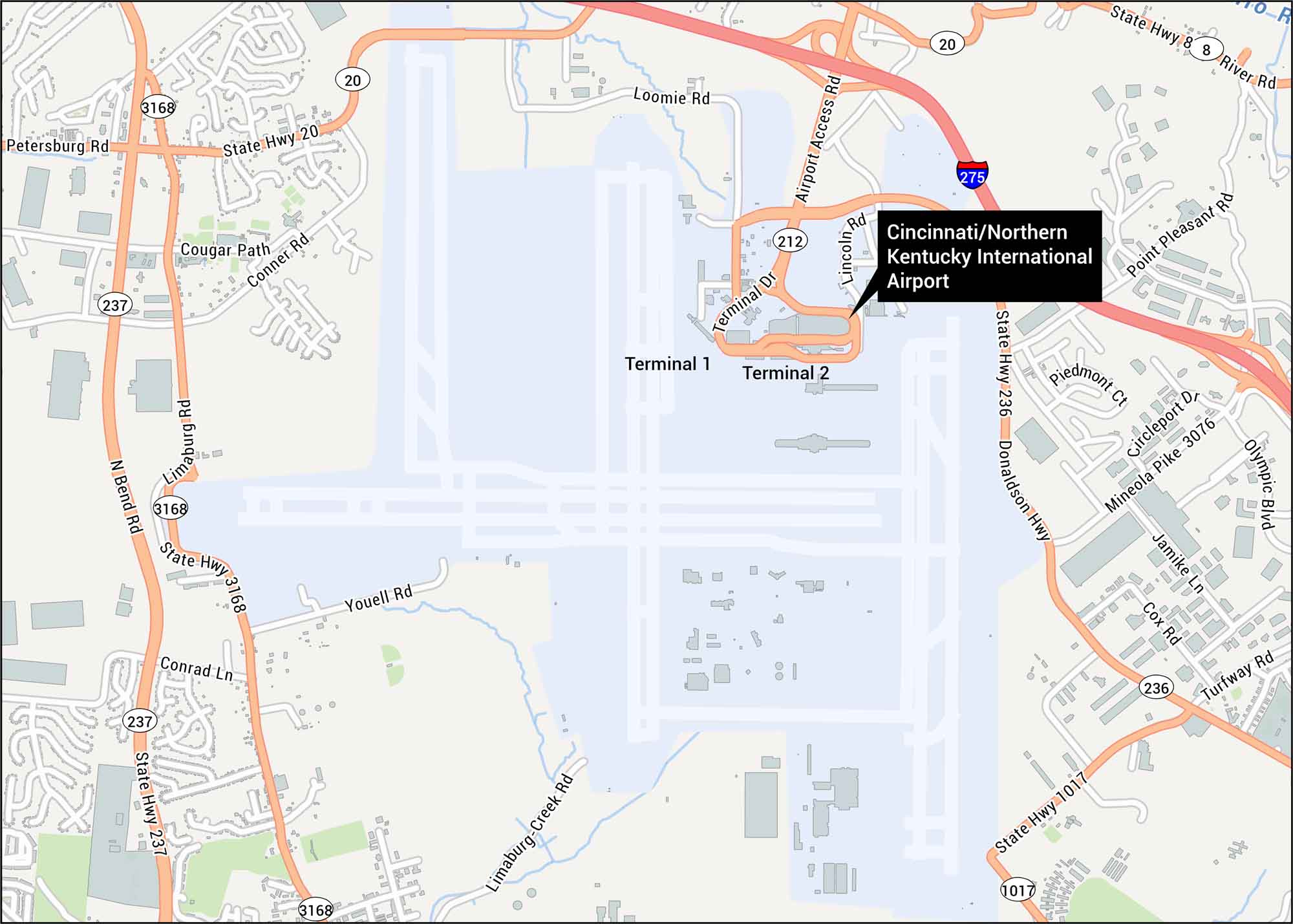
Our Cincinnati International Airport map shows terminals, runways, highways, and roads. The airport sits just southwest of Cincinnati.

Map Information

  • Cincinnati International Airport, Ohio
  • Map of Cincinnati/Northern Kentucky International Airport
  • Free for personal and commercial purpose. Attribution is required. How to attribute?

On the Map

Interstates/Highways: I-275, State Hwy 237, State Hwy 20, State Hwy 236, State Hwy 3168, State Hwy 1017 Major Roads: Donaldson Hwy, Airport Access Rd, Terminal Dr, Mineola Pike, Petersburg Rd, Limaburg Rd, Lincoln Rd, Loomie Rd, Youell Rd, Point Pleasant Rd, Turfway Rd, River Rd, Cougar Path, Conner Rd, Bend Rd Other Landmarks: Cincinnati / Northern Kentucky International Airport, Terminal 1, Terminal 2

References

Leave a Reply

Your email address will not be published. Required fields are marked *