Map of Swansea, Illinois
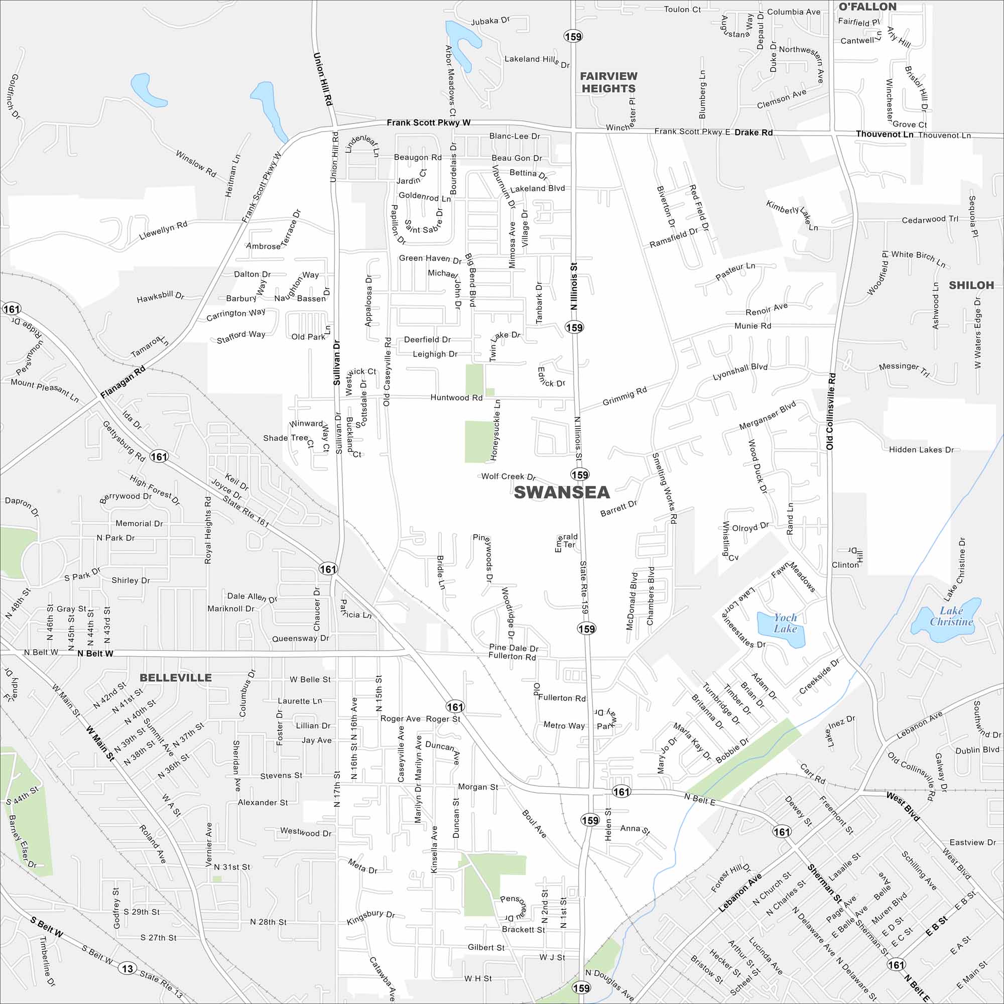
Our road map of Swansea shows this St. Louis suburb. Quiet neighborhoods, shopping, and parks fill the town, making it a calm place to live.
Illinois State Maps
Get to know Illinois with our state maps


Map Information
On the Map
Interstates/Highways: State Rte 159, State Rte 161 Major Roads: Illinois St, Belt Blvd, Frank Scott Pkwy, North Belt, Sullivan Dr, Fullerton Rd, Old Collinsville Rd, Lebanon Ave, Main St, Union Hill Rd, Morgan St, Roger Ave, B Street Rd, Metro Way, Clinton Hill Rd, Munie Rd Lakes and Reservoirs: Yoch Lake, Lake Christine Nearby Communities: Fairview Heights, O’Fallon, Shiloh, BellevilleIllinois City Maps
Explore Chicago and urban regions of Illinois


