Mississippi Physical Map
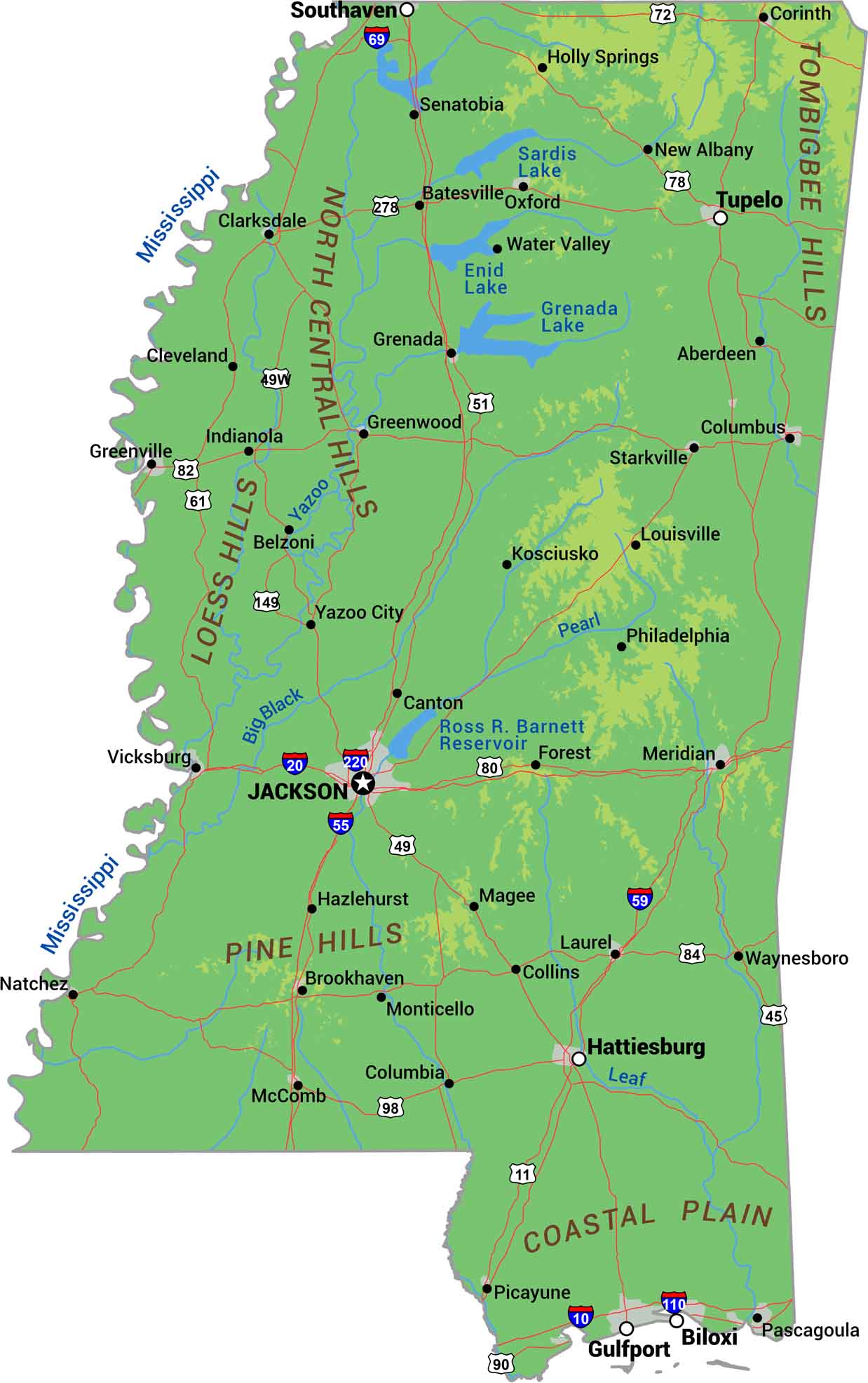
There isn’t much elevation to brag about here. Mississippi is delta and floodplain from top to bottom. The namesake river built the western side. But the northeast brings some hills where the state touches the Tombigbee Hills. Our physical map of Mississippi displays rivers, lowlands, and coastline.
Map Information
On the Map
Physical State Maps
Select any state map below to view its physical map.


Mississippi State Maps
Explore maps of Mississippi’s towns, rivers, and roads.


