Louisiana Physical Map
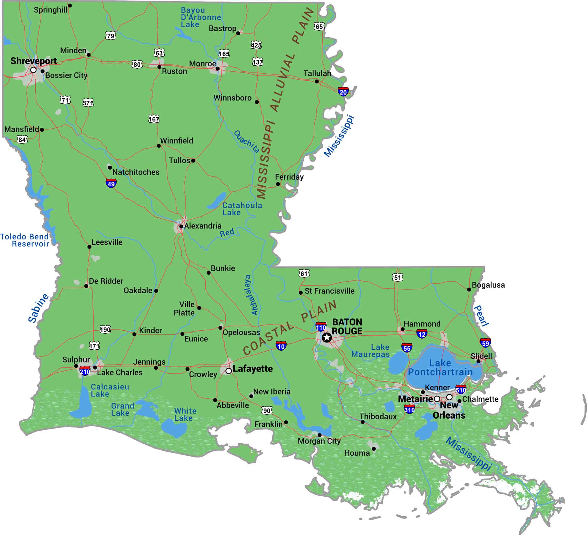
Louisiana is what the Mississippi River built. It’s mostly delta, swamp, and marshland spreading into the Gulf Coast. Sure, northern Louisiana brings some hills, but most of the state is flat and wet. Our physical map of Louisiana shows where land barely rises above water, showing a landscape the river still controls.
Map Information
On the Map
Physical State Maps
Select any state map below to view its physical map.


Louisiana State Maps
Here are maps showcasing the state of Louisiana


