Colorado Physical Map
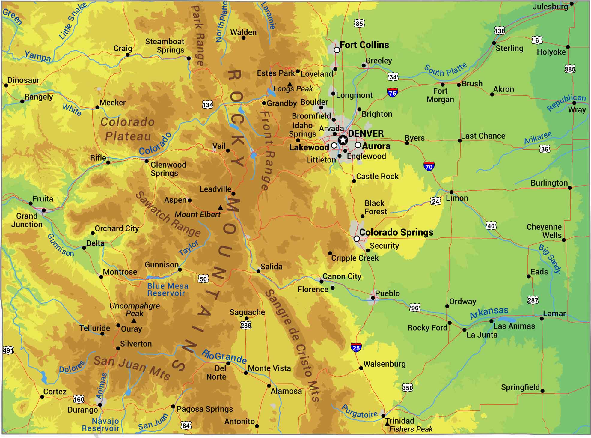
Here’s our physical map of Colorado. The Rockies dominate, running north to south through the center with over fifty summits above 14,000 feet. Western Colorado holds high plateaus and canyon country where the Colorado River starts its journey. The eastern third flattens into Great Plains grassland, holding most urban centers.
Map Information
On the Map
Physical State Maps
Select any state map below to view its physical map.


Colorado State Maps
Browse Colorado with our detailed state maps


