Alabama Physical Map
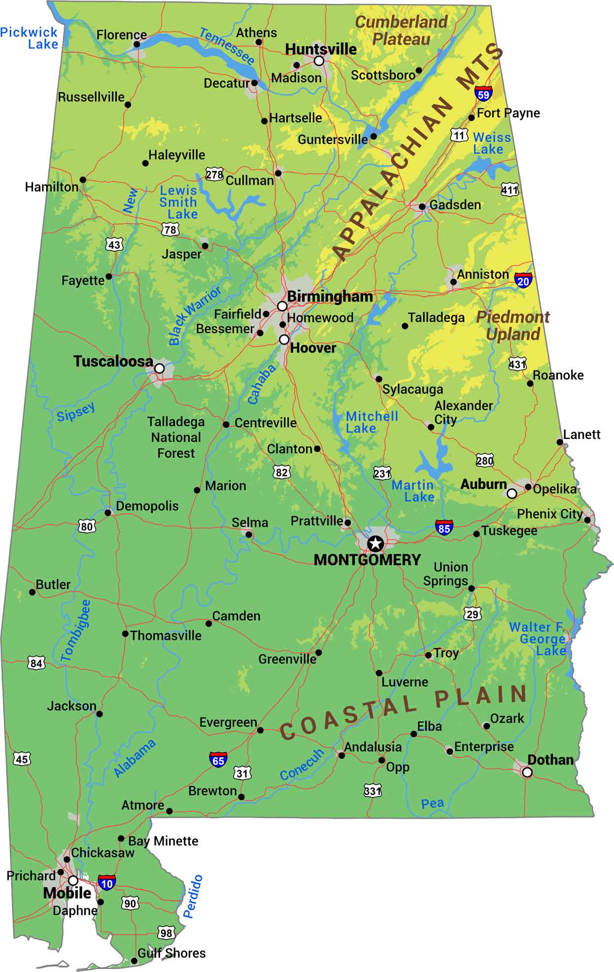
Alabama splits into three distinct regions from north to south. First, the Appalachian Mountains cut through the northeast corner. The middle section is Piedmont plateau with rolling hills that transition the landscape downward. Below that, the Coastal Plain takes over, flattening out as it reaches toward the Gulf Coast.
Map Information
On the Map
Physical State Maps
Select any state map below to view its physical map.


