Kansas County Map
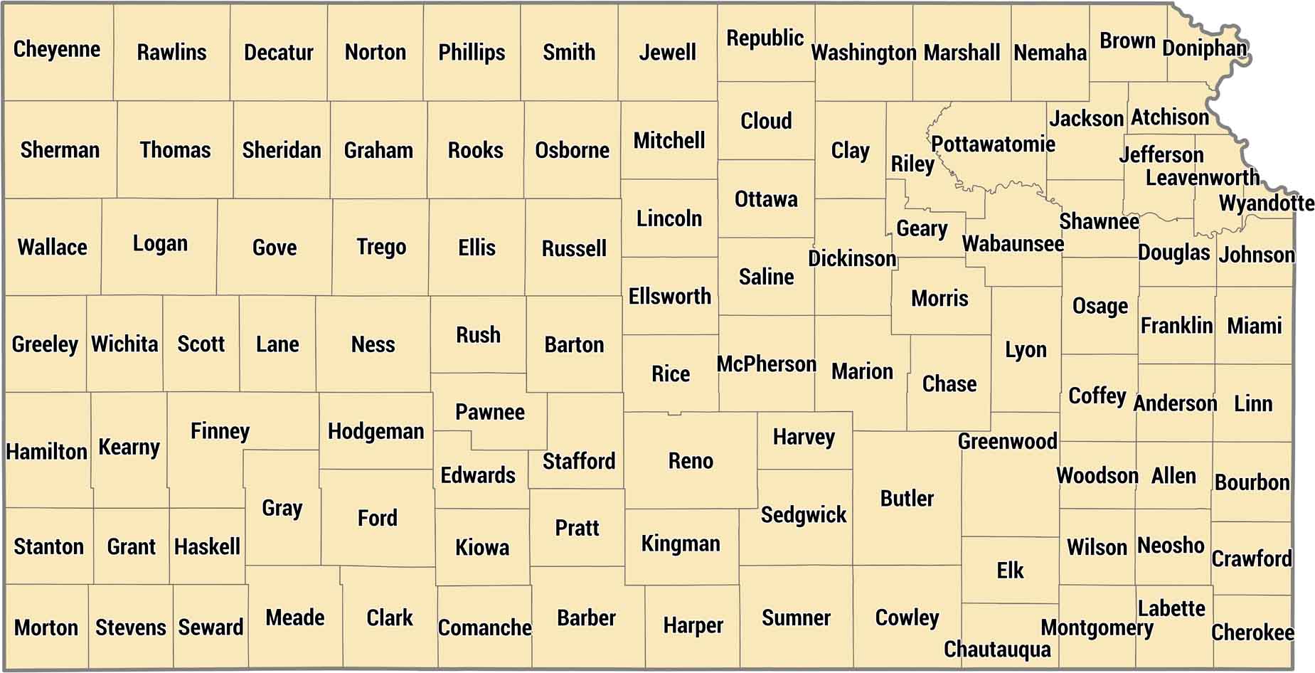
Kansas keeps it organized with 105 counties in tidy rectangles across the plains. This highly organized grid is a result of land surveying across the Great Plains. This is where there were few large geographical features to interrupt the straight-line boundaries.
Map Information
On the Map
Our table below provides you with population, area, and FIPS code for each county.
|
Name |
Population 2024 |
Total Area (sq mi) |
FIPS Code |
|
Allen County |
12,425 |
505.3 |
20-001 |
|
Anderson County |
7,908 |
583.7 |
20-003 |
|
Atchison County |
16,249 |
433.8 |
20-005 |
|
Barber County |
4,070 |
1,136.20 |
20-007 |
|
Barton County |
24,835 |
900.6 |
20-009 |
|
Bourbon County |
14,424 |
639.1 |
20-011 |
|
Brown County |
9,142 |
572.1 |
20-013 |
|
Butler County |
69,158 |
1,446.50 |
20-015 |
|
Chase County |
2,507 |
777.7 |
20-017 |
|
Chautauqua County |
3,339 |
644.8 |
20-019 |
|
Cherokee County |
19,133 |
591 |
20-021 |
|
Cheyenne County |
2,646 |
1,020.90 |
20-023 |
|
Clark County |
1,873 |
977.2 |
20-025 |
|
Clay County |
7,969 |
655.6 |
20-027 |
|
Cloud County |
8,723 |
718 |
20-029 |
|
Coffey County |
8,301 |
654.1 |
20-031 |
|
Comanche County |
1,694 |
789.7 |
20-033 |
|
Cowley County |
34,186 |
1,132.40 |
20-035 |
|
Crawford County |
38,904 |
595 |
20-037 |
|
Decatur County |
2,716 |
894.1 |
20-039 |
|
Dickinson County |
18,621 |
851.9 |
20-041 |
|
Doniphan County |
7,575 |
398.3 |
20-043 |
|
Douglas County |
121,989 |
474.6 |
20-045 |
|
Edwards County |
2,731 |
622 |
20-047 |
|
Elk County |
2,436 |
650.5 |
20-049 |
|
Ellis County |
29,007 |
900.4 |
20-051 |
|
Ellsworth County |
6,316 |
723.3 |
20-053 |
|
Finney County |
38,354 |
1,302.70 |
20-055 |
|
Ford County |
34,072 |
1,099.10 |
20-057 |
|
Franklin County |
26,273 |
577.1 |
20-059 |
|
Geary County |
35,459 |
404.6 |
20-061 |
|
Gove County |
2,658 |
1,071.80 |
20-063 |
|
Graham County |
2,370 |
898.8 |
20-065 |
|
Grant County |
7,097 |
575.1 |
20-067 |
|
Gray County |
5,730 |
869.3 |
20-069 |
|
Greeley County |
1,152 |
778.4 |
20-071 |
|
Greenwood County |
5,871 |
1,152.60 |
20-073 |
|
Hamilton County |
2,488 |
997.6 |
20-075 |
|
Harper County |
5,413 |
802.8 |
20-077 |
|
Harvey County |
33,642 |
540.7 |
20-079 |
|
Haskell County |
3,591 |
577.9 |
20-081 |
|
Hodgeman County |
1,673 |
860.3 |
20-083 |
|
Jackson County |
13,525 |
658 |
20-085 |
|
Jefferson County |
18,332 |
556.7 |
20-087 |
|
Jewell County |
2,899 |
914.4 |
20-089 |
|
Johnson County |
632,276 |
479.9 |
20-091 |
|
Kearny County |
3,808 |
871 |
20-093 |
|
Kingman County |
6,946 |
866.7 |
20-095 |
|
Kiowa County |
2,436 |
722.9 |
20-097 |
|
Labette County |
19,692 |
653.1 |
20-099 |
|
Lane County |
1,482 |
717.6 |
20-101 |
|
Leavenworth County |
84,670 |
468.9 |
20-103 |
|
Lincoln County |
2,928 |
720.5 |
20-105 |
|
Linn County |
9,841 |
606.4 |
20-107 |
|
Logan County |
2,694 |
1,073.10 |
20-109 |
|
Lyon County |
32,520 |
855.4 |
20-111 |
|
McPherson County |
30,334 |
900.6 |
20-113 |
|
Marion County |
11,670 |
953.7 |
20-115 |
|
Marshall County |
9,950 |
905.1 |
20-117 |
|
Meade County |
3,892 |
979.3 |
20-119 |
|
Miami County |
35,737 |
590.3 |
20-121 |
|
Mitchell County |
5,803 |
719.2 |
20-123 |
|
Montgomery County |
30,459 |
651.5 |
20-125 |
|
Morris County |
5,279 |
702.9 |
20-127 |
|
Morton County |
2,485 |
729.9 |
20-129 |
|
Nemaha County |
10,062 |
719.4 |
20-131 |
|
Neosho County |
15,552 |
577.8 |
20-133 |
|
Ness County |
2,617 |
1,075.00 |
20-135 |
|
Norton County |
5,335 |
881.3 |
20-137 |
|
Osage County |
15,737 |
719.8 |
20-139 |
|
Osborne County |
3,353 |
894.4 |
20-141 |
|
Ottawa County |
5,853 |
721.3 |
20-143 |
|
Pawnee County |
6,012 |
754.6 |
20-145 |
|
Phillips County |
4,733 |
894.6 |
20-147 |
|
Pottawatomie County |
26,876 |
861.6 |
20-149 |
|
Pratt County |
9,137 |
735.7 |
20-151 |
|
Rawlins County |
2,432 |
1,069.60 |
20-153 |
|
Reno County |
61,417 |
1,272.10 |
20-155 |
|
Republic County |
4,613 |
720.4 |
20-157 |
|
Rice County |
9,284 |
728 |
20-159 |
|
Riley County |
72,557 |
622.1 |
20-161 |
|
Rooks County |
4,748 |
895.1 |
20-163 |
|
Rush County |
2,810 |
718 |
20-165 |
|
Russell County |
6,620 |
899.4 |
20-167 |
|
Saline County |
53,459 |
721.3 |
20-169 |
|
Scott County |
4,914 |
717.7 |
20-171 |
|
Sedgwick County |
536,081 |
1,009.10 |
20-173 |
|
Seward County |
21,276 |
640.4 |
20-175 |
|
Shawnee County |
177,942 |
555.7 |
20-177 |
|
Sheridan County |
2,397 |
896.2 |
20-179 |
|
Sherman County |
5,796 |
1,056.30 |
20-181 |
|
Smith County |
3,541 |
897 |
20-183 |
|
Stafford County |
3,901 |
794.9 |
20-185 |
|
Stanton County |
2,071 |
680.4 |
20-187 |
|
Stevens County |
5,035 |
727.4 |
20-189 |
|
Sumner County |
22,336 |
1,184.90 |
20-191 |
|
Thomas County |
7,802 |
1,074.80 |
20-193 |
|
Trego County |
2,774 |
899.6 |
20-195 |
|
Wabaunsee County |
7,112 |
799.7 |
20-197 |
|
Wallace County |
1,472 |
913.7 |
20-199 |
|
Washington County |
5,572 |
898.7 |
20-201 |
|
Wichita County |
2,072 |
718.6 |
20-203 |
|
Wilson County |
8,398 |
575.1 |
20-205 |
|
Woodson County |
3,111 |
505.3 |
20-207 |
|
Wyandotte County |
169,418 |
156.2 |
20-209 |
Kansas State Maps
Explore every corner of Kansas with our state maps


State County Maps
Click on a map below to check out county maps of each state.


