Buckhead Map, Atlanta
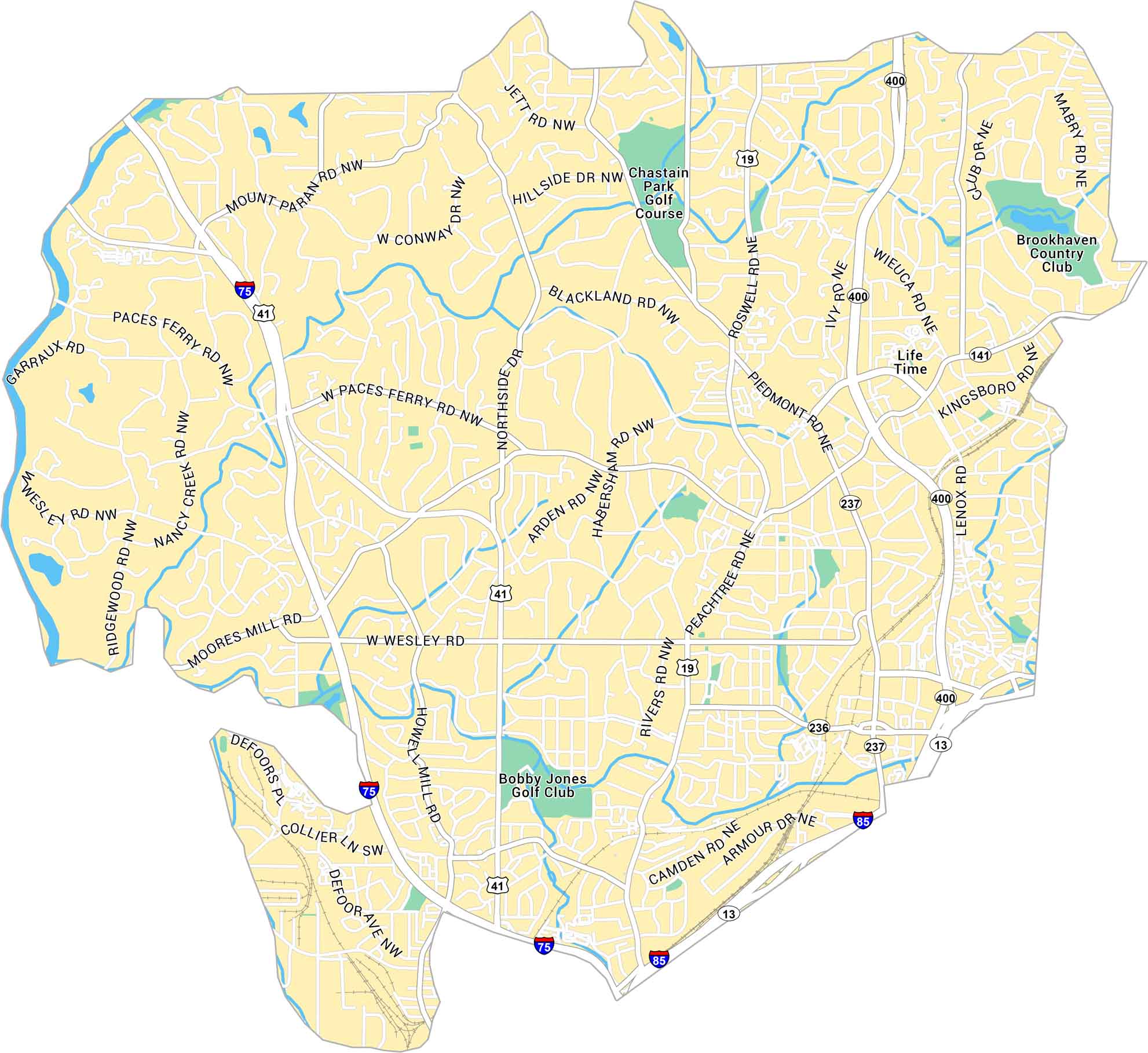
This map of Buckhead highlights Atlanta’s upscale core neighborhood. It shows Peachtree Road, Interstate 75 and its plethora of golf courses.
Map Information
On the Map
Interstates/Highways: I-75, I-85, US Hwy 41, State Rte 400, State Rte 19, State Rte 237, State Rte 236, State Rte 141, State Rte 13 Major Roads: Peachtree Rd, Piedmont Rd, Roswell Rd, Northside Dr, West Paces Ferry Rd, Moores Mill Rd, Howell Mill Rd, Wieuca Rd, Lenox Rd, Kingsboro Rd, Mount Paran Rd, West Conway Dr, Jett Rd, Hillside Dr, Blackland Rd, Habersham Rd, Arden Rd, Rivers Rd, Camden Rd, Armour Dr Golf Courses: Chastain Park Golf Course, Bobby Jones Golf Club, Brookhaven Country ClubGeorgia City Maps
Get to know Atlanta and Georgia’s urban areas


