Downtown Fort Worth Map
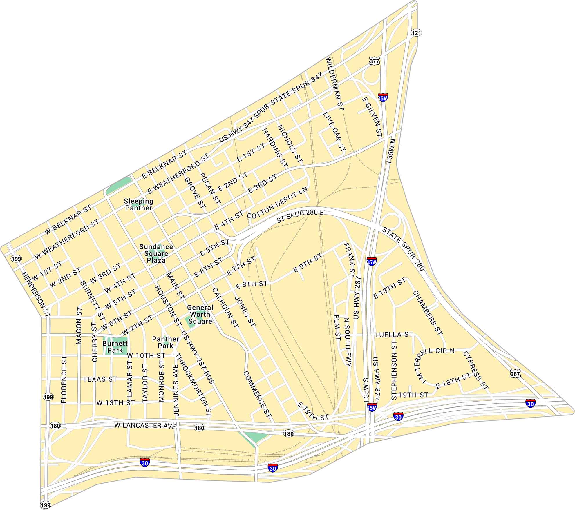
Explore Downtown Fort Worth with this detailed map. You can spot Sundance Square and all the streets leading toward the Stockyards. It also includes local parks, connecting roads, and major highways.
Map Information
On the Map
Interstates/Highways: I-30, I-35W, US Hwy 287, US Hwy 377, US Hwy 287 BUS, US Hwy 347 Spur, State Spur 347, State Spur 280, State Rte 180, State Rte 199, State Rte 121 Major Roads: Main St, Houston St, Commerce St, Throckmorton St, Belknap St, Weatherford St, Lancaster Ave, Henderson St, Calhoun St, Jones St, Taylor St, Lamar St, Burnett St, Cherry St, Macon St, Florence St, Jennings Ave, Monroe St, 4th St, 5th St Parks: Burnett Park, Panther Park, General Worth Square, Sundance Square Plaza Landmarks: Sleeping PantherCity Maps of Texas
Explore our map collection of Texas cities.


