Historic District Map, Savannah
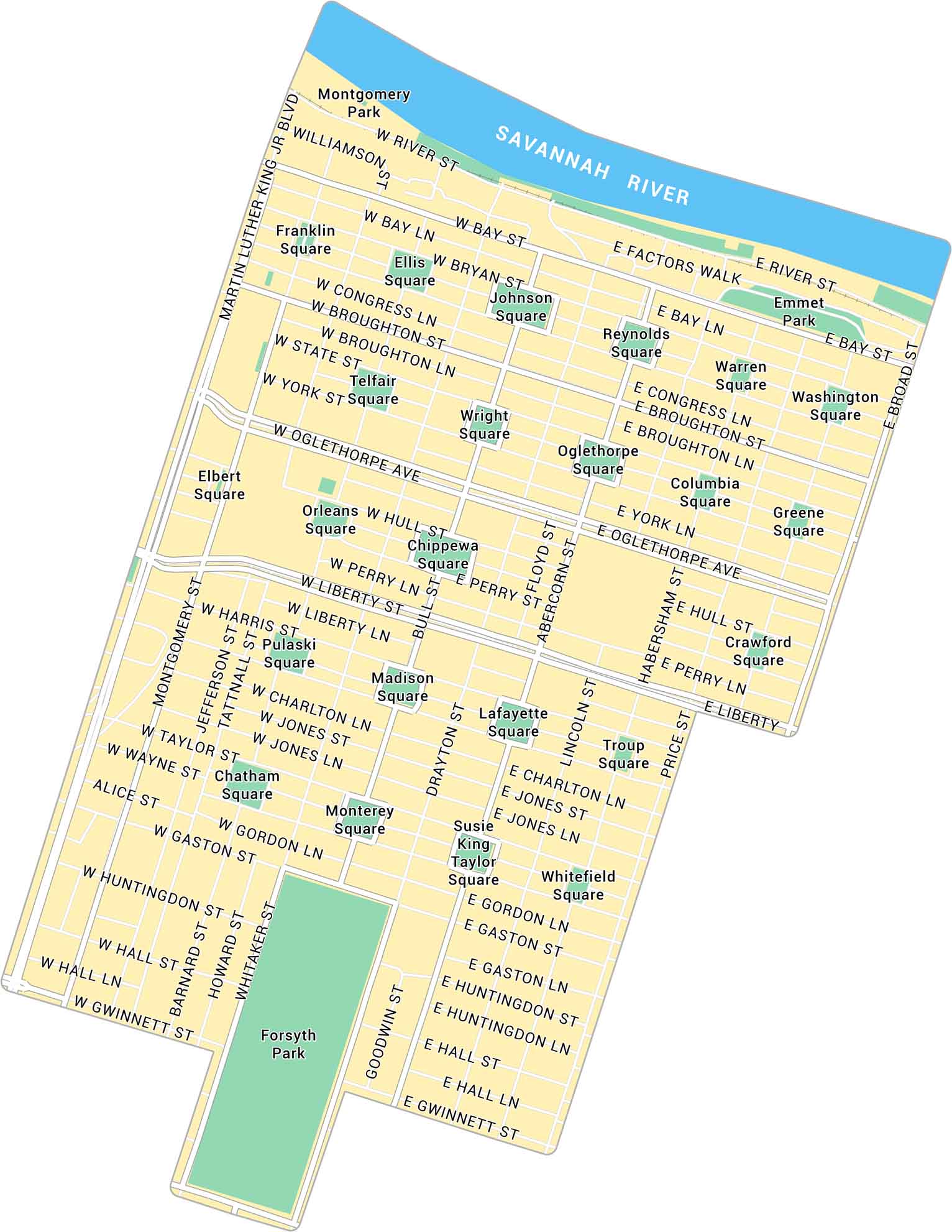
In the heart of Savannah, the Historic District spreads out under oak trees and old brick buildings. This map shows its squares, riverfront streets, and the Savannah River.
Map Information
On the Map
Major Roads: Bay St, River St, Oglethorpe Ave, Liberty St, Gwinnett St, Martin Luther King Jr Blvd, Broad St, Montgomery St, Jefferson St, Barnard St, Whitaker St, Bull St, Drayton St, Abercorn St, Lincoln St, Habersham St, Price St, Broughton St, Congress St, Gastson St Major Rivers: Savannah River Parks: Forsyth Park, Emmet Park, Franklin Square, Ellis Square, Johnson Square, Reynolds Square, Warren Square, Washington Square, Telfair Square, Wright Square, Oglethorpe Square, Columbia Square, Greene Square, Elbert Square, Orleans Square, Chippewa Square, Crawford Square, Pulaski Square, Madison Square, Lafayette Square, Troup Square, Chatham Square, Monterey Square, Susie King Taylor Square, Whitefield Square, Montgomery ParkGeorgia City Maps
Get to know Atlanta and Georgia’s urban areas


