Midtown Map, Atlanta
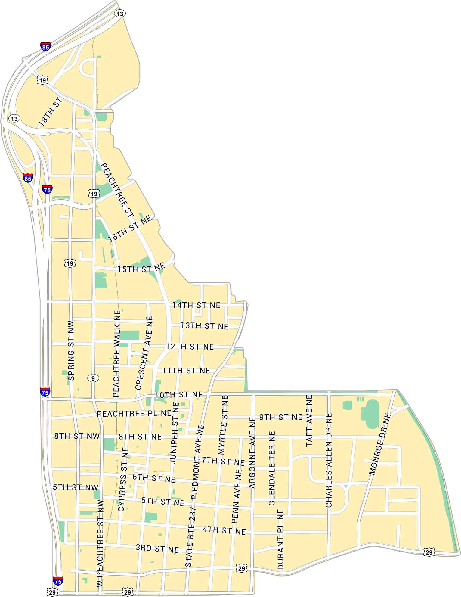
Our map of Midtown Atlanta centers on the stretch between Downtown and Buckhead. It lays out Peachtree Street, Piedmont Avenue, and the streets that tie the area together. It’s a busy core of the city with lots of businesses and green spaces.
Map Information
On the Map
Interstates/Highways: I-75, I-85, US Hwy 19, US Hwy 29, State Rte 13, State Rte 237, State Rte 9 Major Roads: Peachtree St, West Peachtree St, Piedmont Ave, Spring St, 14th St, 10th St, 17th St, 16th St, 15th St, 13th St, 12th St, 11th St, 8th St, 7th St, 6th St, 5th St, 4th St, 3rd St, Monroe Dr, Juniper StGeorgia City Maps
Get to know Atlanta and Georgia’s urban areas


