Map of Urbana, Illinois
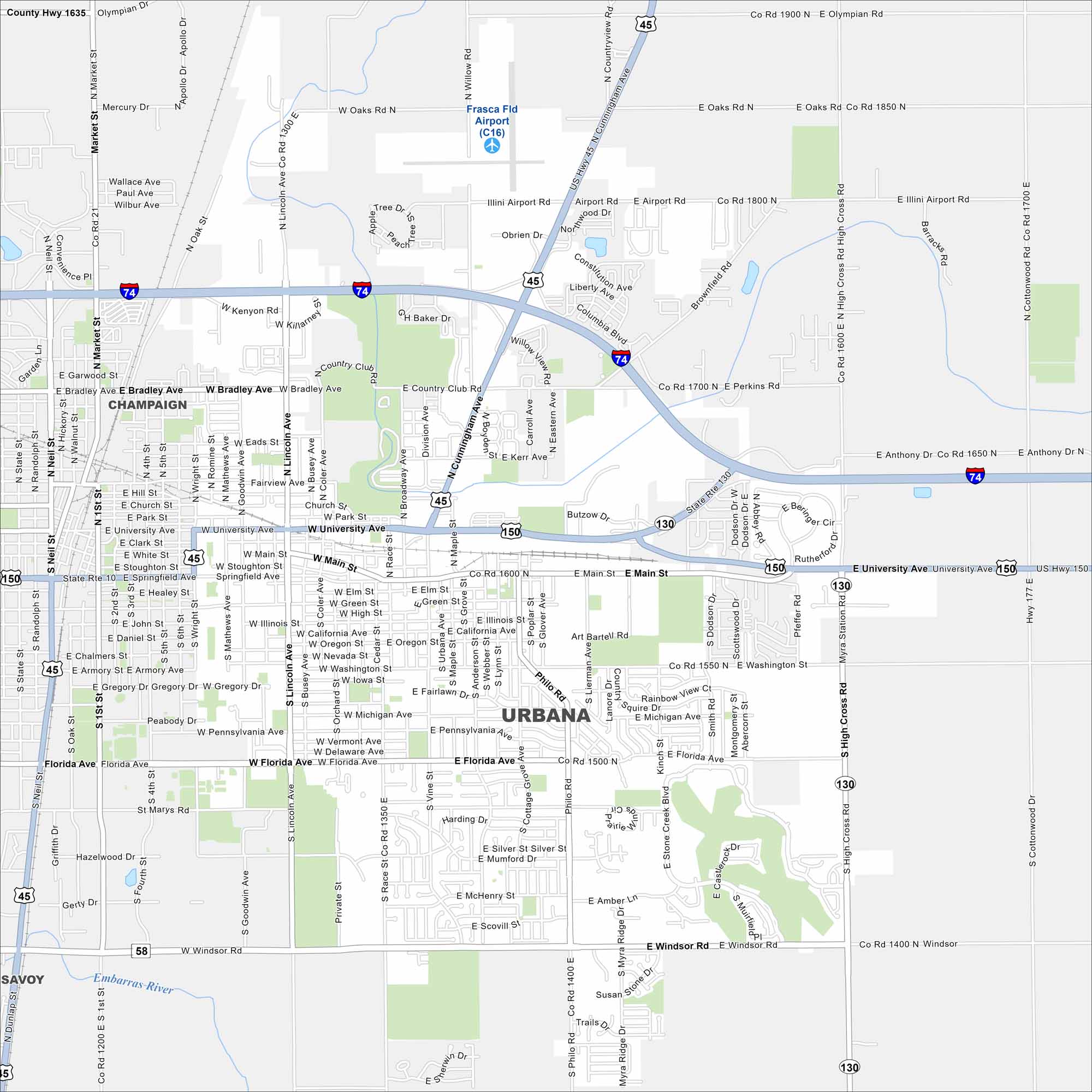
Our map of Urbana shows you around this college town. Home to the University of Illinois, it blends campus life with quiet neighborhoods.
Illinois State Maps
Get to know Illinois with our state maps


Map Information
On the Map
Interstates/Highways: I-74, US Hwy 45, US Hwy 150, State Rte 130 Major Roads: University Ave, Main St, Cunningham Ave, Florida Ave, Windsor Rd, Philo Rd, High Cross Rd, Lincoln Ave, Race St, Vine St, Goodwin Ave, Broadway Ave, Coler Ave, Wright St, Market St, Neil St, Bradley Ave, Perkins Rd, Washington St, Mumford Dr Airports: Frasca Fld Airport (C16) Major Rivers: Embarras River Nearby Communities: Champaign, SavoyIllinois City Maps
Explore Chicago and urban regions of Illinois


