Home » State Maps » Satellite Map of Georgia

Satellite Map of Georgia

Georgia Satellite Map

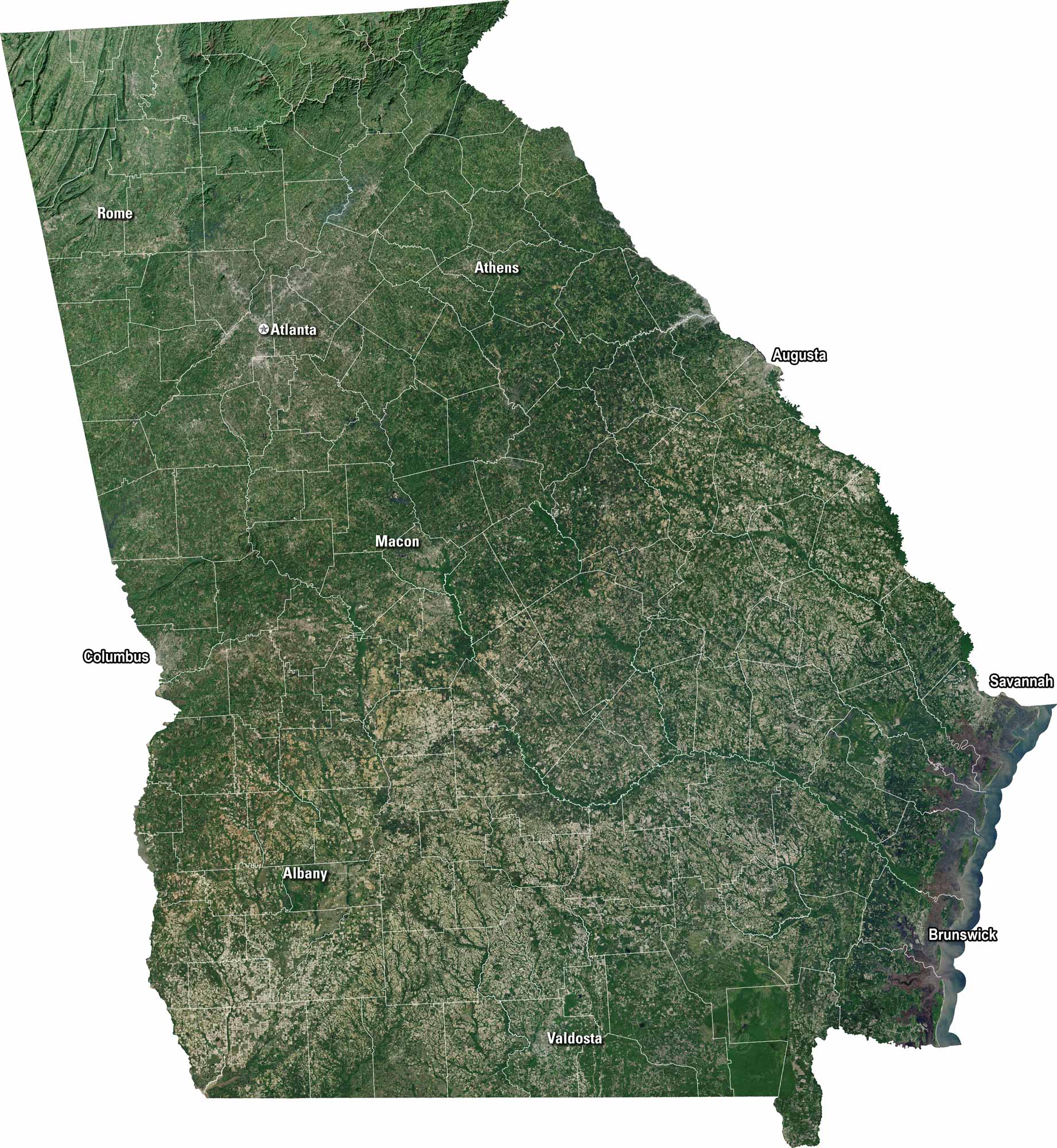
Georgia is a bunch of green and gold in our satellite map. Cities like Atlanta and Savannah stand out in endless countryside. Rivers wind across the state. But mountain forests occupy much of the north with coastal marshes in the southeast.

Map Information

  • State of Georgia
  • Satellite Map of Georgia with Landsat-8 Imagery
  • Free for personal and commercial purpose. Attribution is required. How to attribute?

On the Map

Georgia Location Map
Cities/Towns (Labels): Rome, Atlanta, Athens, Augusta, Columbus, Macon, Savannah, Albany, Valdosta, Brunswick Mountain Ranges: Blue Ridge Mountains (dark green/textured area in the far north) Lakes/Reservoirs: Lake Lanier (northeast of Atlanta), Lake Seminole (southwest corner), Lake Strom Thurmond (north of Augusta) Major Rivers: Savannah River (eastern border), Chattahoochee River (western border) Swamps: Okefenokee Swamp (dark area in the southeast)

References

  1. NASA Worldview Earthdata
  2. USGS State Mosaics

Leave a Reply

Your email address will not be published. Required fields are marked *