Satellite Map of Louisiana
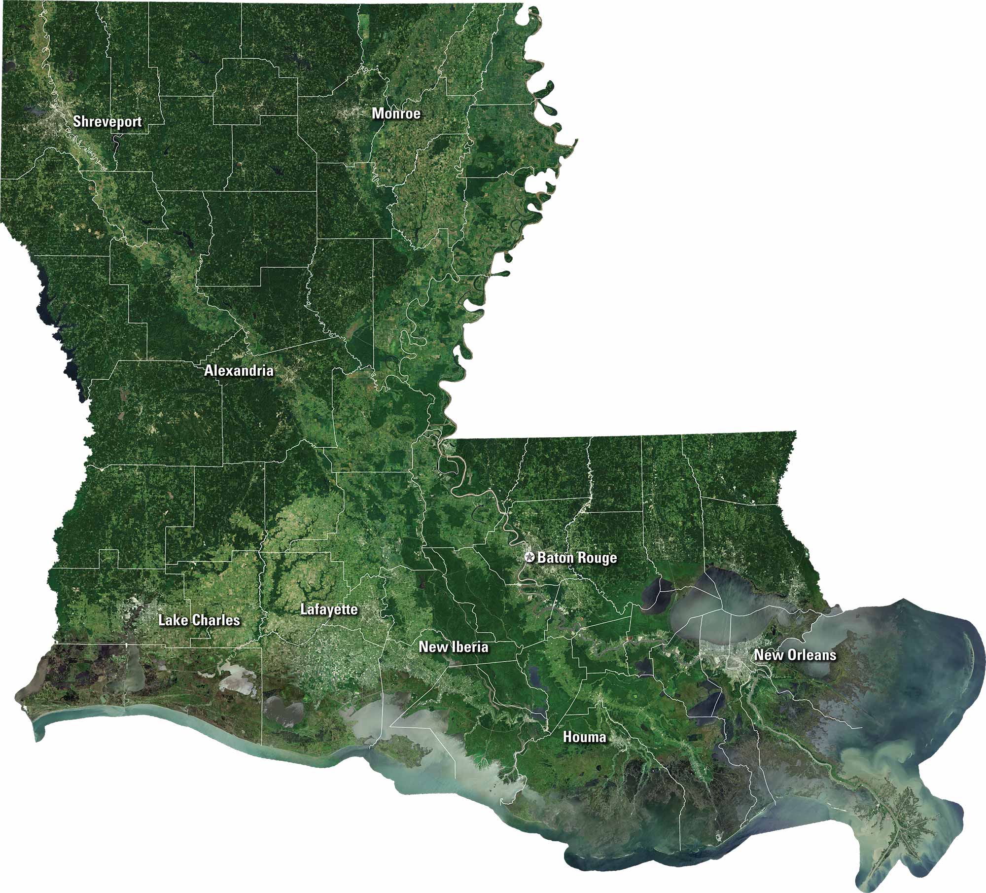
Our satellite map of Louisiana captures its bayous, rivers, and the sweep of the Mississippi Delta. You can spot New Orleans, Baton Rouge, and Shreveport from above. Marshlands meet farmland, and highways connect it all.
Map Information
On the Map
Neighboring State Maps
Find satellite map of neighboring states


