Home » State Maps » Satellite Map of Washington

Satellite Map of Washington

Washington Satellite Map

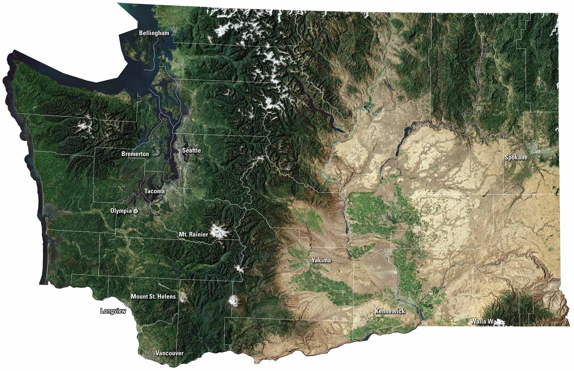
Snow-capped peaks stretch across the Cascades, while green forests blanket much of the land. You’ll find Seattle and Olympia, which is the state capital. Islands and bays shape the Puget Sound. Our Washington satellite map shows it both wild and full of life.

Map Information

  • State of Washington
  • Satellite Map of Washington with Landsat-8 Imagery
  • Free for personal and commercial purpose. Attribution is required. How to attribute?

On the Map

Washington Location Map
Cities/Towns (Labels): Bellingham, Seattle, Bremerton, Tacoma, Olympia, Yakima, Kennewick, Walla Walla, Spokane, Vancouver, Longview Mountain Ranges: Cascade Range (central), Olympic Mountains (west), Blue Mountains (southeast) Volcanoes (Peaks): Mt. Rainier, Mt. St. Helens, Mt. Baker, Mt. Adams Water Bodies: Puget Sound, Columbia River, Lake Chelan, Potholes Reservoir

References

  1. NASA Worldview Earthdata
  2. USGS State Mosaics

Leave a Reply

Your email address will not be published. Required fields are marked *