Map of Virginia Beach, Virginia
Get to know Virginia Beach with this city map. From the boardwalk to the Chesapeake Bay, it’s a coastal city full of life. You’ll also find airports, parks and major roads in our map.
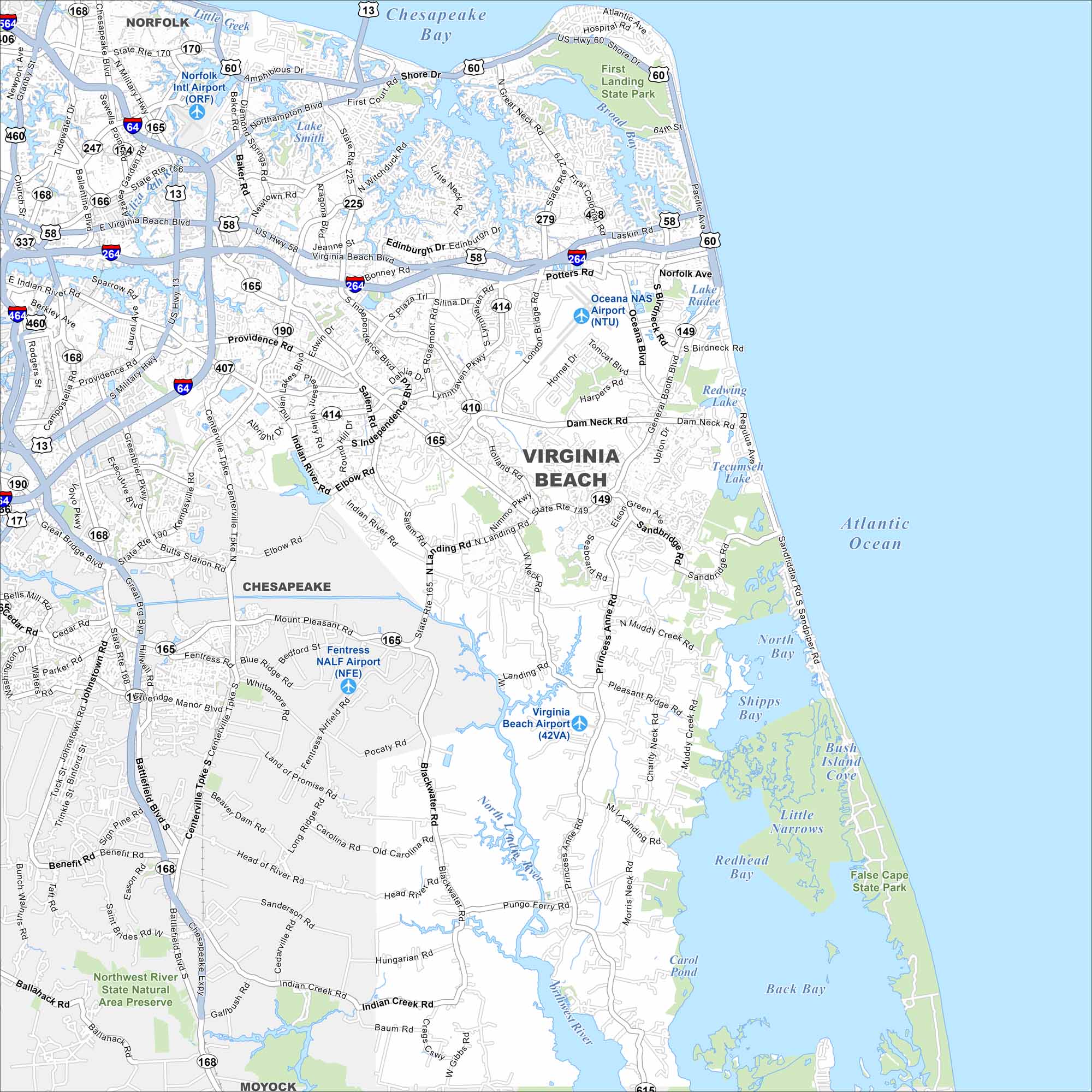
Map Information
On the Map
Interstates/Highways: I-64, I-264, US Hwy 13, US Hwy 58, US Hwy 60, US Hwy 460, State Rte 149, State Rte 165, State Rte 166, State Rte 168, State Rte 190, State Rte 225, State Rte 279 Major Roads: Shore Dr, Atlantic Ave, Laskin Rd, Virginia Beach Blvd, Northampton Blvd, Independence Blvd, Princess Anne Rd, Dam Neck Rd, Sandbridge Rd, Indian River Rd, Kempsville Rd, Centerville Tpke, Battlefield Blvd, Elbow Rd, Nimmo Pkwy, Pungo Ferry Rd, Blackwater Rd, Salem Rd, Holland Rd, Rosemont Rd Airports: Oceana NAS Airport (NTU), Virginia Beach Airport (42VA), Fentress NALF Airport (NFE), Norfolk Intl Airport (ORF) Lakes and Reservoirs: Atlantic Ocean, Chesapeake Bay, Back Bay, Redhead Bay, Shipps Bay, North Bay, Lake Smith, Lake Lawson, Lake Rudee, Redwing Lake, Tecumseh Lake Major Rivers: North Landing River, Northwest River Parks and Preserves: First Landing State Park, False Cape State Park, Northwest River State Natural Area Preserve Nearby Communities: Norfolk, Chesapeake, MoyockVirginia State Maps
Spanning coasts and mountains, here are our maps of Virginia.


City Maps of Virginia
Traverse Virginia using our city maps


