Home » Physical Maps » Yosemite Valley Topographic Map

Yosemite Valley Topographic Map

Yosemite Valley Map

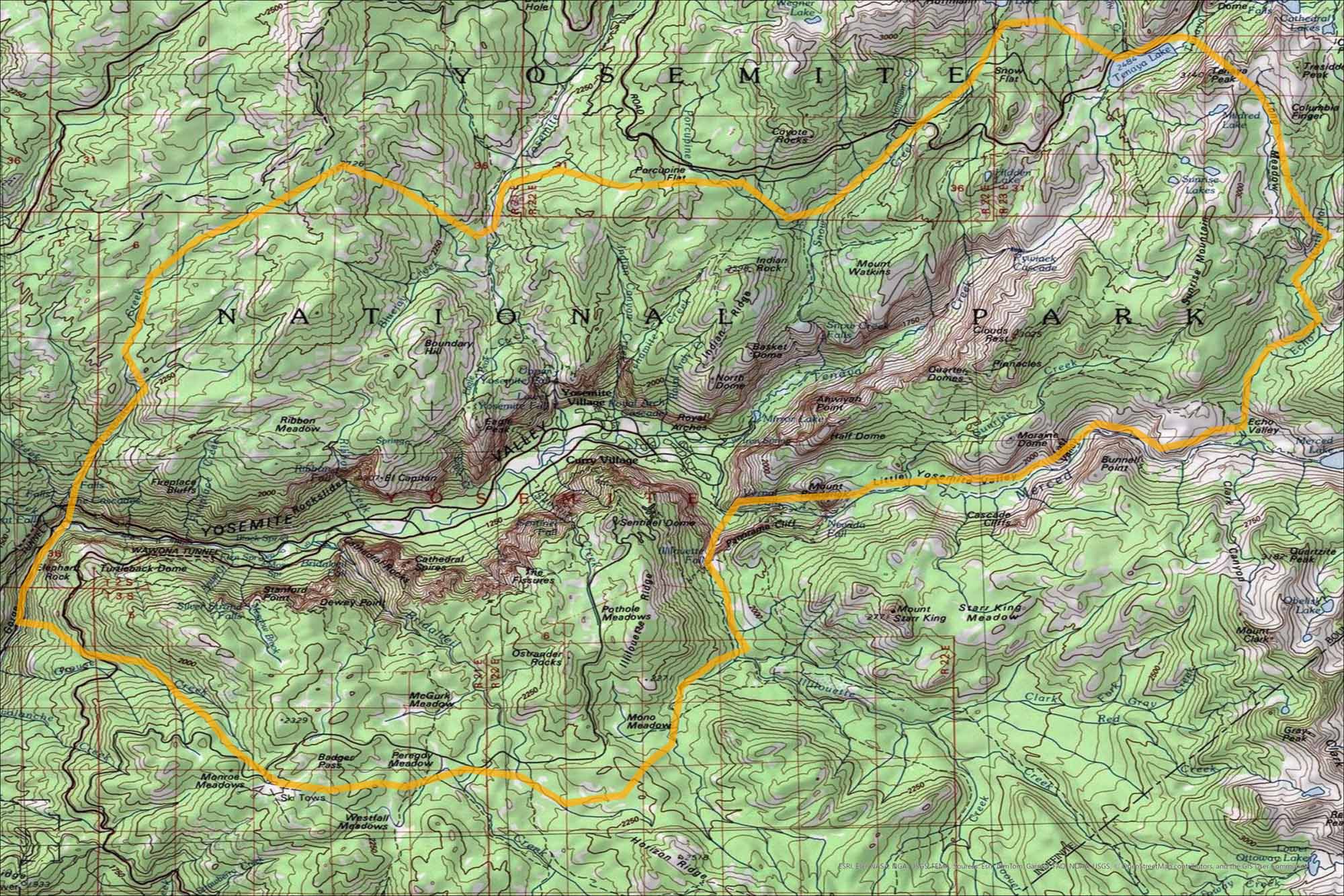
Our map of Yosemite Valley shows the contours of its granite cliffs. Landmarks like El Capitan and Half Dome stand out. It’s the heart of Yosemite National Park, where most visitors begin their trip.

Map Information

  • Yosemite Valley, California
  • Topographic Map of Yosemite Valley
  • Free for personal and commercial purpose. Attribution is required. How to attribute?

On the Map

Major Roads: North Falls Rd, Tioga Rd, Big Oak Flat Rd, Wawona Rd Rivers/Lakes: Merced River, Tenaya Lake, Mirror Lake, Tenaya Creek, Yosemite Creek, Bridalveil Creek, Illilouette Creek, Ribbon Creek, Cascade Creek, Tamarack Creek, Bluejay Creek, Porcupine Creek, Snow Creek, Sunrise Creek, Echo Creek, Clark Fork, Red Creek Cities/Towns: Yosemite Village, Curry Village Campgrounds/Park Sites: North Dome, Half Dome, El Capitan, Sentinel Dome, Glacier Point, Badger Pass, Wawona Tunnel Other Landmarks: Yosemite Falls, Bridalveil Fall, Nevada Fall, Vernal Fall, Ribbon Fall, Illilouette Fall, Silver Strand Falls, Royal Arches, Cathedral Spires, Cathedral Rocks, Sentinel Rock, The Fissures, Clouds Rest, Quarter Domes, Basket Dome

References

  1. USGS TopoView (Yosemite Valley)
  2. Yosemite Valley in Google Maps

Leave a Reply

Your email address will not be published. Required fields are marked *