Map of Woodstock, Georgia
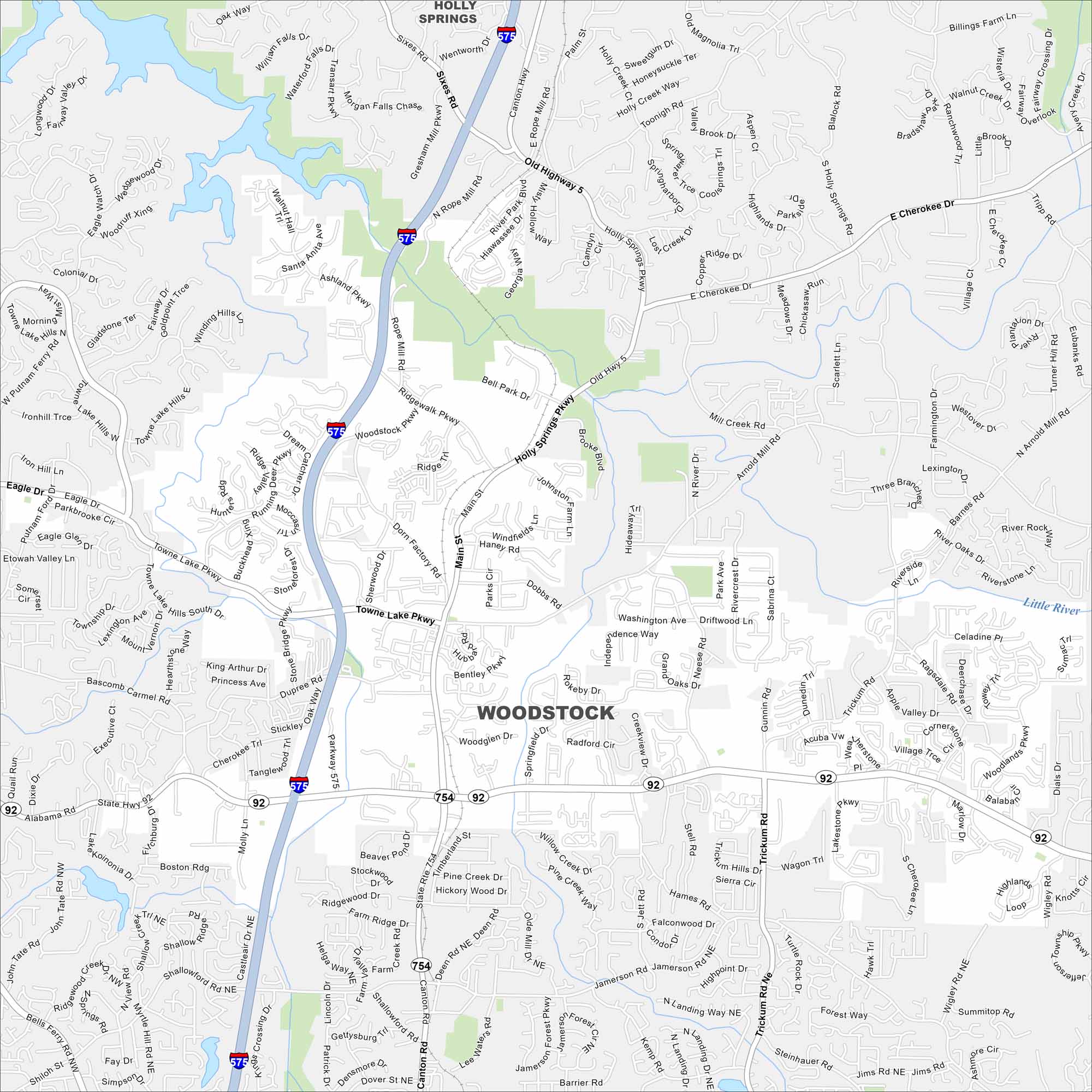
Our road map of Woodstock, Georgia shows its growing downtown and surrounding neighborhoods. The city sits near the foothills of the Appalachians.
Georgia State Maps
Browse through our Georgia map collection


Map Information
On the Map
Interstates/Highways: I-575, State Rte 92, State Rte 754 Major Roads: Main St, Towne Lake Pkwy, Arnold Mill Rd, Trickum Rd, Woodstock Rd, Bells Ferry Rd, Neese Rd, Holly Springs Pkwy, Rope Mill Rd, Ridgewalk Pkwy, Eagle Dr, Putman Ford Dr, Dupree Rd, Canton Rd, Jamerson Rd, Shallowford Rd, Little River Marina Rd, Bascomb Carmel Rd, Highway 92, Victoria Rd Lakes and Reservoirs: Beaver Pond Major Rivers: Little River Nearby Communities: Holly SpringsGeorgia City Maps
Get to know Atlanta and Georgia’s urban areas


