Map of Stonecrest, Georgia
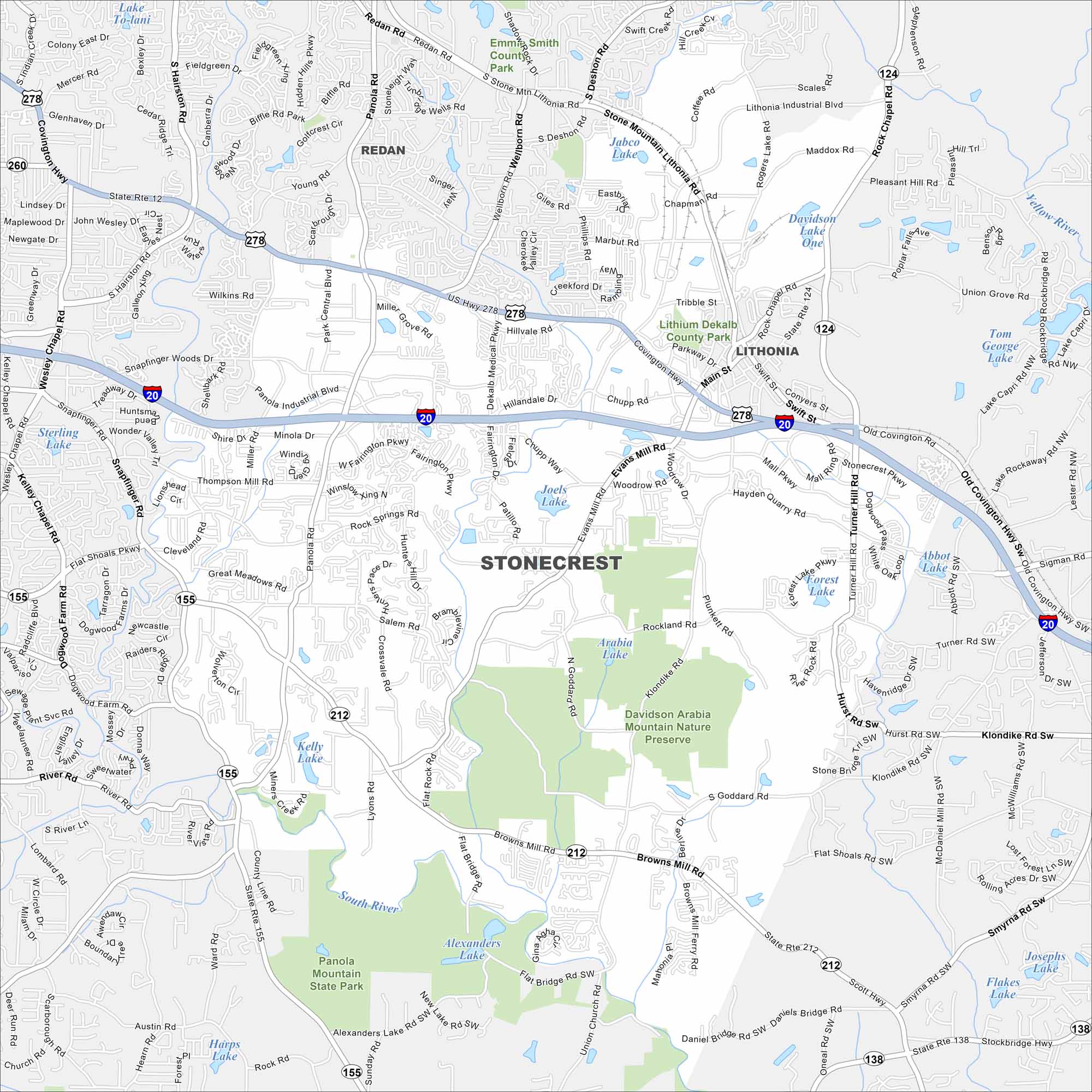
We’ve mapped out every major road in Stonecrest. You’ll see how this young city connects to Atlanta and nearby Arabia Mountain trails.
Georgia State Maps
Browse through our Georgia map collection


Map Information
On the Map
Interstates/Highways: I-20, US Hwy 278, State Rte 12, State Rte 155, State Rte 212, State Rte 124, State Rte 138 Major Roads: Panola Rd, Evans Mill Rd, Turner Hill Rd, Stonecrest Pkwy, Mall Pkwy, Klondike Rd, Browns Mill Rd, Lithonia Industrial Blvd, Covington Hwy, Rock Chapel Rd, Snapfinger Rd, Flat Shoals Pkwy, Miller Grove Rd, Salem Rd, DeKalb Medical Pkwy, Pleasant Hill Rd, Union Grove Rd, Sigman Rd, McDaniel Mill Rd, Hayden Quarry Rd Lakes and Reservoirs: Davidson Lake One, Tom George Lake, Sterling Lake, Joels Lake, Arabia Lake, Forest Lake, Abbot Lake, Kelly Lake, Alexanders Lake, Harps Lake, Josephs Lake, Jabco Lake Major Rivers: South River, Yellow River Parks and Preserves: Davidson Arabia Mountain Nature Preserve, Panola Mountain State Park, Emma Smith County Park Nearby Communities: Redan, LithoniaGeorgia City Maps
Get to know Atlanta and Georgia’s urban areas


