Map of Stockbridge, Georgia
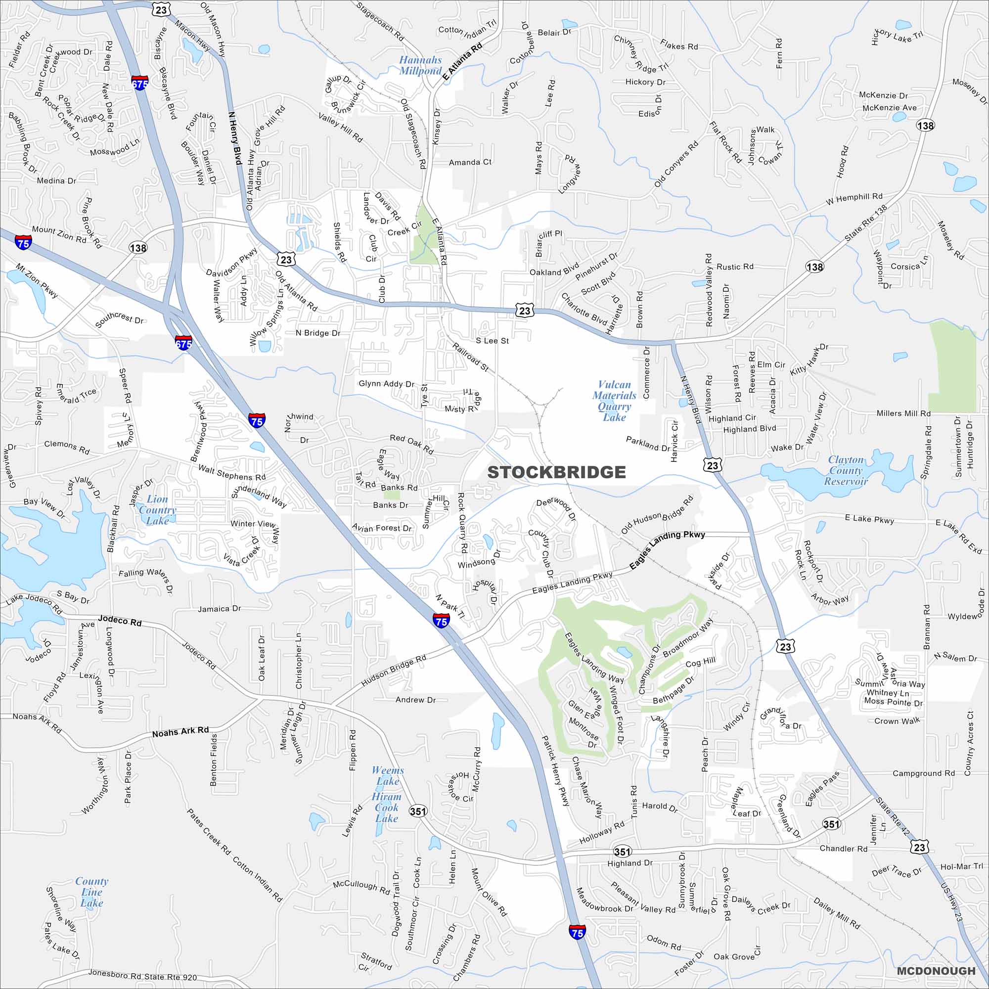
Our map of Stockbridge highlights a growing city just south of Atlanta. Panola Mountain State Park to the northeast is one of its best outdoor escapes.
Georgia State Maps
Browse through our Georgia map collection


Map Information
On the Map
Interstates/Highways: I-75, I-675, US Hwy 23, State Rte 138, State Rte 42, State Rte 351, US Hwy 23/State Rte 42 Major Roads: Eagles Landing Pkwy, Davidson Pkwy, Walt Stephens Rd, Hudson Bridge Rd, Rock Quarry Rd, Old Atlanta Hwy, Old Conyers Rd, Millers Mill Rd, Flippen Rd, Campground Rd, Pates Creek Rd, Speer Rd, Jodeco Rd, Noahs Ark Rd, Westview Dr, Lake Rd, East Lake Rd, Dailey Mill Rd, Lee Rd, Brannan Rd Airports: Berry Hill Airport Lakes and Reservoirs: Clayton County Reservoir, Vulcan Materials Quarry Lake, Joree Millpond, Lake Jodeco, Hannahs Millpond, Weems Lake, Hiram Cook Lake, County Line Lake, Lake Dr Nearby Communities: McDonoughGeorgia City Maps
Get to know Atlanta and Georgia’s urban areas


