Map of South Fulton, Georgia
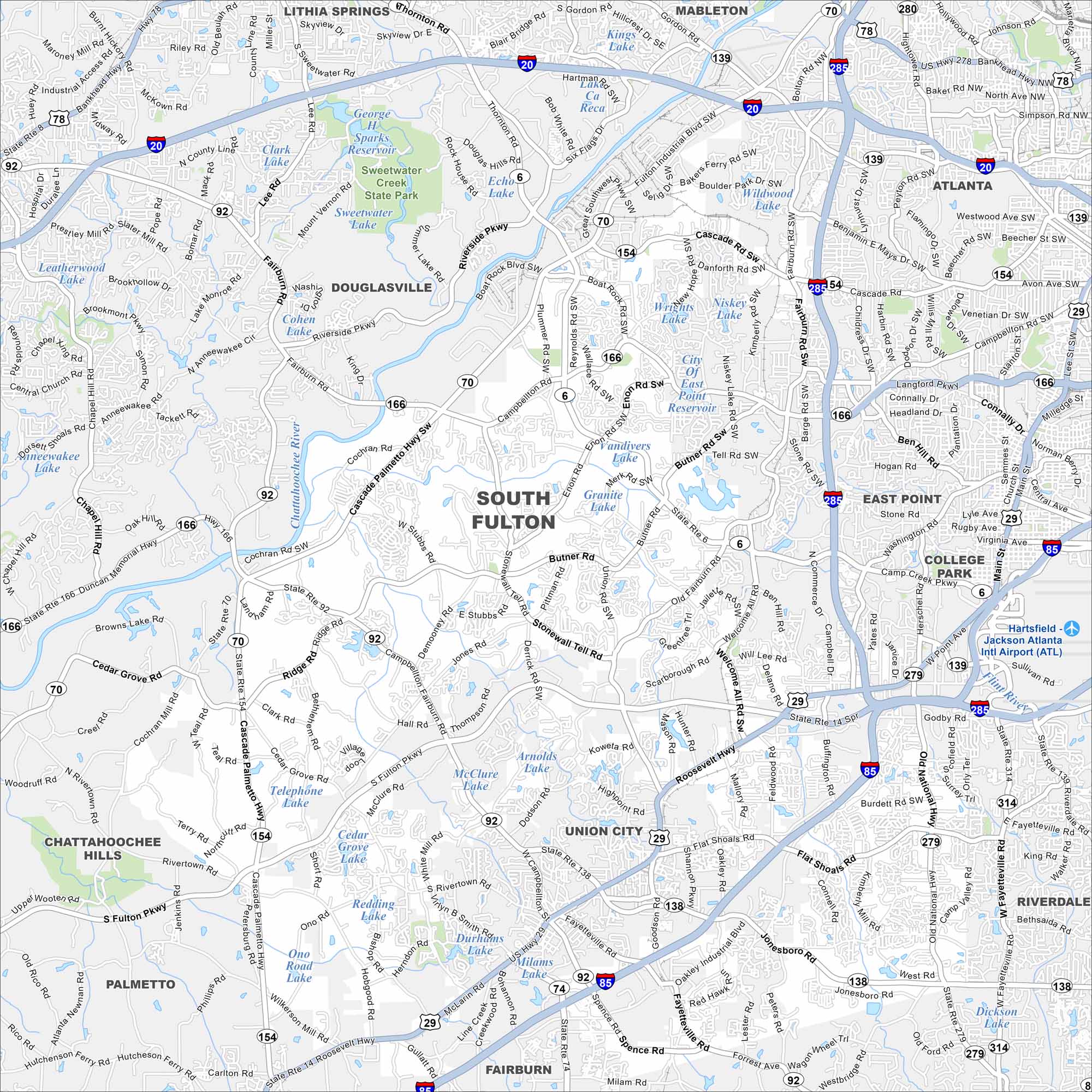
Familiarize yourself with South Fulton using our map. This newer city on Atlanta’s edge covers neighborhoods, parks, and plenty of green space.
Georgia State Maps
Browse through our Georgia map collection


Map Information
On the Map
Interstates/Highways: I-20, I-85, I-285, US Hwy 29, State Rte 6, State Rte 14, State Rte 70, State Rte 74, State Rte 92, State Rte 138, State Rte 139, State Rte 154, State Rte 166 Major Roads: Cascade Rd, Campbellton Rd, Fairburn Rd, Fulton Industrial Blvd Sw, Roosevelt Hwy, South Fulton Pkwy, Stonewall Tell Rd, Butner Rd, Jonesboro Rd, Cascade Palmetto Hwy, Thornton Rd, Riverside Pkwy, Boat Rock Rd, Welcome All Rd Sw, Enon Rd, Union Rd, Cochran Rd Sw, Peters Rd, Old National Hwy, Fayetteville Rd Airports: Hartsfield-Jackson Atlanta Intl Airport (ATL) Lakes and Reservoirs: Sparks Reservoir, Clark Lake, Sweetwater Lake, Echo Lake, Cohen Lake, City Of East Point Reservoir, Vandivers Lake, Granite Lake, Arnolds Lake, McClure Lake, Cedar Grove Lake, Telephone Lake, Redding Lake, Durham Lake, Ono Road Lake, Milams Lake, Dickson Lake, Wildwood Lake, Niskey Lake, Wrights Lake Major Rivers: Chattahoochee River, Flint River Parks and Preserves: Sweetwater Creek State Park Nearby Communities: Atlanta, East Point, College Park, Union City, Fairburn, Palmetto, Chattahoochee Hills, Douglasville, Lithia Springs, Mableton, RiverdaleGeorgia City Maps
Get to know Atlanta and Georgia’s urban areas


