Map of Savannah, Georgia
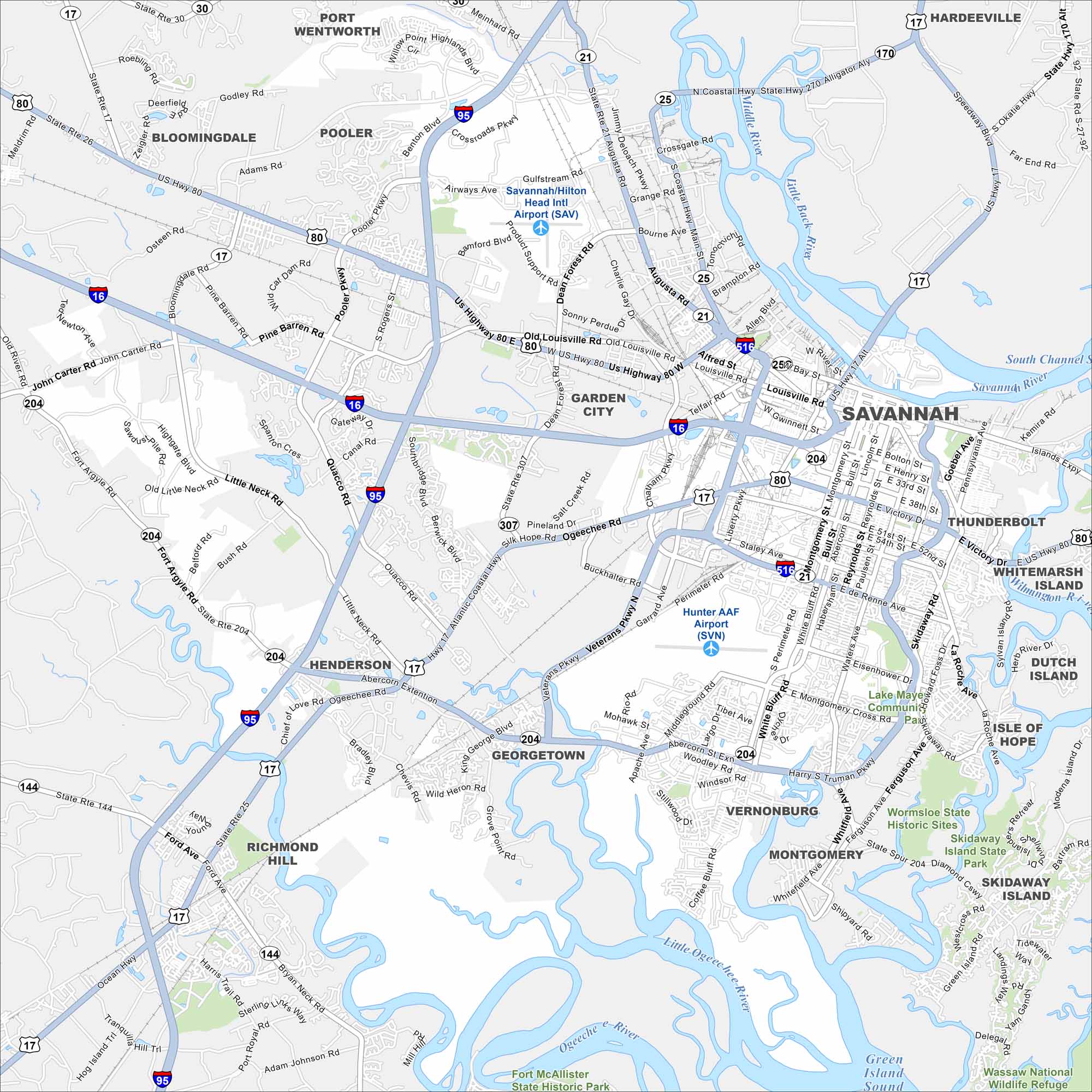
Our map of Savannah highlights the city’s famous squares, oak-lined streets, and riverfront. Walking or driving, it’s the perfect guide for exploring this historic city of the South.
Georgia State Maps
Browse through our Georgia map collection


Map Information
On the Map
Interstates/Highways: I-95, I-16, I-516, US Hwy 80, US Hwy 17, US Hwy 21, State Rte 21, State Rte 25, State Rte 26, State Rte 30, State Rte 204, State Rte 144 Major Roads: Abercorn St, Ogeechee Rd, De Renne Ave, Victory Dr, Montgomery St, Bay St, Louisville Rd, Dean Forest Rd, Pooler Pkwy, Quacco Rd, Little Neck Rd, Fort Argyle Rd, Gulfstream Rd, Airways Ave, Coastal Hwy, Eisenhower Dr, Waters Ave, Skidaway Rd, Ferguson Ave, White Bluff Rd Airports: Savannah/Hilton Head Intl Airport (SAV), Hunter AAF Airport (SVN) Lakes and Reservoirs: Lake Mayer, Green Island Sound, Wassaw National Wildlife Refuge Major Rivers: Savannah River, Little Back River, Middle River, Ogeechee River, Little Ogeechee River, Vernon River Parks and Preserves: Wormsloe State Historic Sites, Skidaway Island State Park, Fort McAllister State Historic Park, Waasaw National Wildlife Refuge Nearby Communities: Garden City, Pooler, Port Wentworth, Bloomingdale, Thunderbolt, Whitemarsh Island, Dutch Island, Isle of Hope, Skidaway Island, Montgomery, Vernonburg, Georgetown, Henderson, Richmond Hill, HardeevilleGeorgia City Maps
Get to know Atlanta and Georgia’s urban areas


