Map of Sandy Springs, Georgia
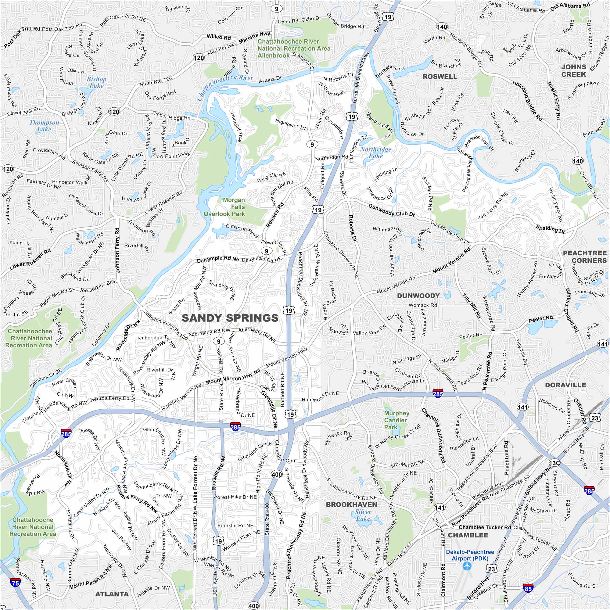
Our map of Sandy Springs guides you through its bucketload of parks and the banks of the Chattahoochee River. It’s a suburban city with plenty of outdoor escapes.
Georgia State Maps
Browse through our Georgia map collection


Map Information
On the Map
Interstates/Highways: I-285, US Hwy 19, State Rte 400, State Rte 9, State Rte 141 Major Roads: Roswell Rd, Peachtree Dunwoody Rd, Abernathy Rd Nw, Mount Vernon Hwy, Johnson Ferry Rd, Powers Ferry Rd, Glenridge Dr, Northside Dr, Windsor Pkwy, Wieuca Rd, Peachtree Rd, Dunwoody Club Dr, Spalding Dr, Roberts Dr, Chamblee Dunwoody Rd, Perimeter Ctr Pkwy, Ashford Dunwoody Rd, Chamblee Tucker Rd, Buford Hwy, Peachtree Industrial Blvd Lakes and Reservoirs: Morgan Falls, Northridge Lake, Silver Lake Major Rivers: Chattahoochee River Parks and Preserves: Chattahoochee River National Recreation Area, Overlook Park, Murphey Candler Park Nearby Communities: Dunwoody, Brookhaven, Chamblee, Doraville, Roswell, Peachtree Corners, AtlantaGeorgia City Maps
Get to know Atlanta and Georgia’s urban areas


