Map of Peachtree Corners, Georgia
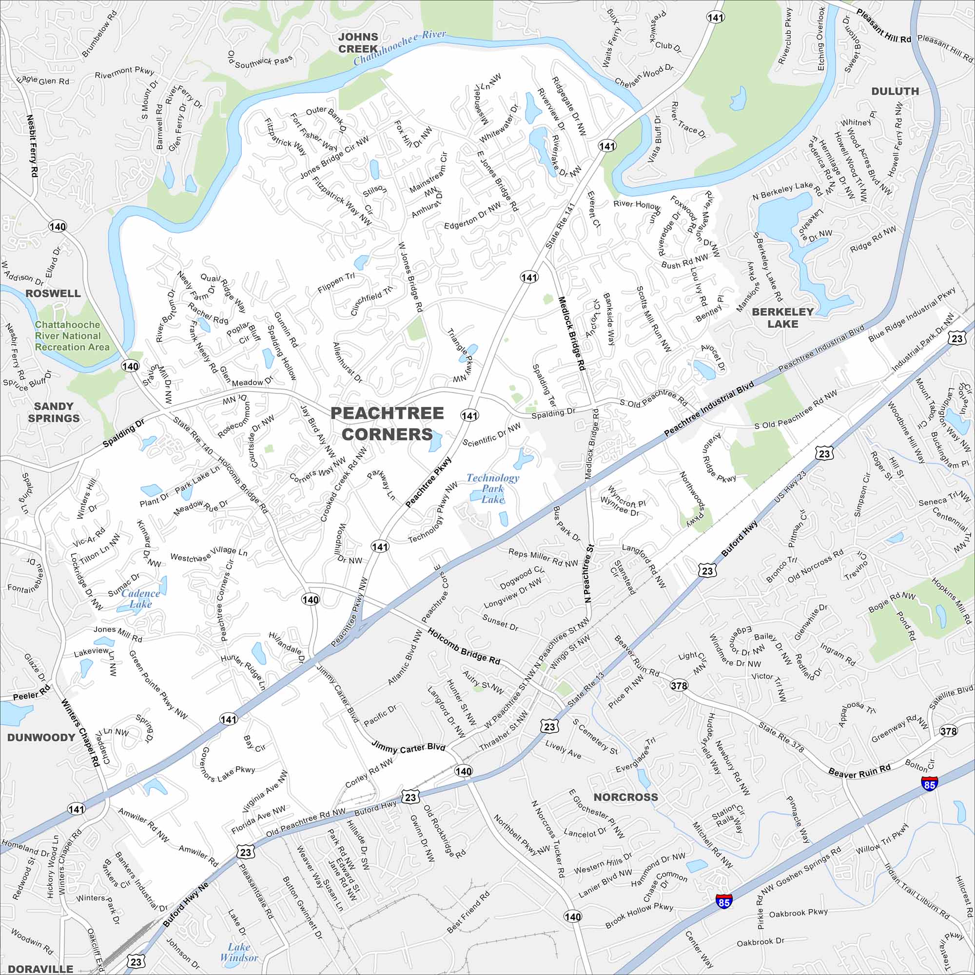
Peachtree Corners sits along the Chattahoochee River northeast of Atlanta. Check out the map to see its residential areas and business parks. The city has grown quickly as part of Gwinnett County.
Georgia State Maps
Browse through our Georgia map collection


Map Information
On the Map
Interstates/Highways: I-85, US Hwy 23, State Rte 141, State Rte 140, State Rte 13, State Rte 378 Major Roads: Peachtree Industrial Blvd, Holcomb Bridge Rd, Buford Hwy, Peachtree Pkwy, Medlock Bridge Rd, Spalding Dr, Jimmy Carter Blvd, Beaver Ruin Rd, Jones Bridge Rd, Thrasher St, Atlantic Blvd, Crooked Creek Rd, Winters Chapel Rd, Amwiler Rd, Pleasantdale Rd, Gwinnett Dr, Northbelt Pkwy, Brook Hollow Pkwy, Mitchell Rd, Goshen Springs Rd Lakes and Reservoirs: Technology Park Lake, Cadence Lake, Lake Windsor Major Rivers: Chattahoochee River Parks and Preserves: Chattahoochee River National Recreation Area Nearby Communities: Johns Creek, Duluth, Berkeley Lake, Norcross, Doraville, Dunwoody, Sandy Springs, RoswellGeorgia City Maps
Get to know Atlanta and Georgia’s urban areas


