Map of Peachtree City, Georgia
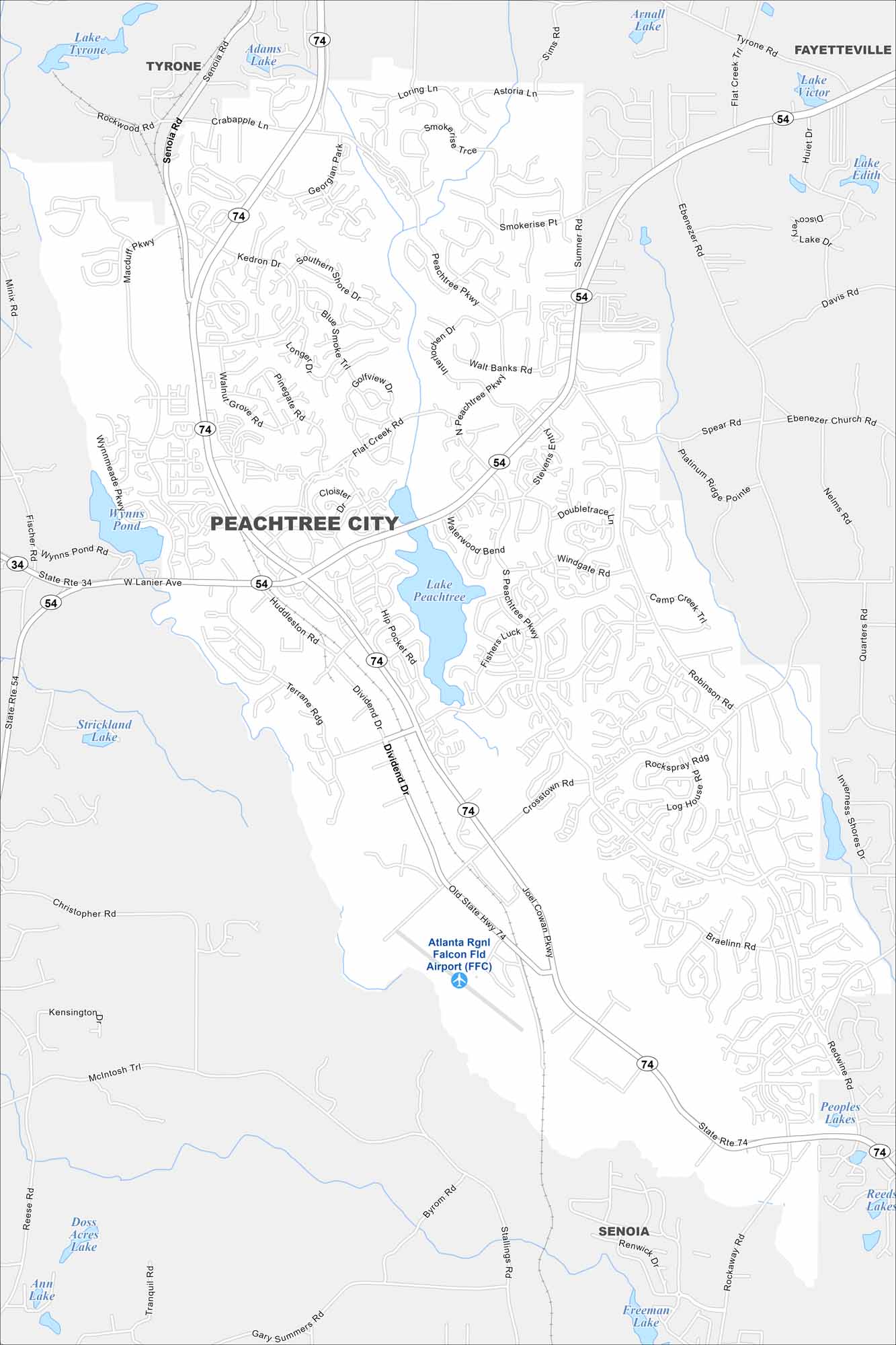
Our map of Peachtree City highlights a network of winding through neighborhoods. Lakes and greenbelts are everywhere here. Lake Peachtree is the main one. It’s a planned city just south of Atlanta.
Georgia State Maps
Browse through our Georgia map collection


Map Information
On the Map
Interstates/Highways: State Rte 74, State Rte 54, State Rte 34 Major Roads: Joel Cowan Pkwy, Peachtree Pkwy, Crosstown Rd, Robinson Rd, Macduff Pkwy, Senoia Rd, Walt Banks Rd, Huddleston Rd, Dividend Dr, Hip Pocket Rd, Kedron Dr, TDK Blvd, McIntosh Trl, Kelly Dr, Stevens Entry, Braelinn Rd, Redwine Rd, Ebenezer Rd, Davis Rd, Flat Creek Rd Airports: Atlanta Rgnl Falcon Fld Airport (FFC) Lakes and Reservoirs: Lake Peachtree, Lake Tyrone, Adams Lake, Arnall Lake, Lake Victor, Lake Edith, Wynns Pond, Strickland Lake, Doss Acres Lake, Ann Lake, Peoples Lakes, Reeds Lakes, Freeman Lake Nearby Communities: Tyrone, Fayetteville, SenoiaGeorgia City Maps
Get to know Atlanta and Georgia’s urban areas


