Newark Airport Map
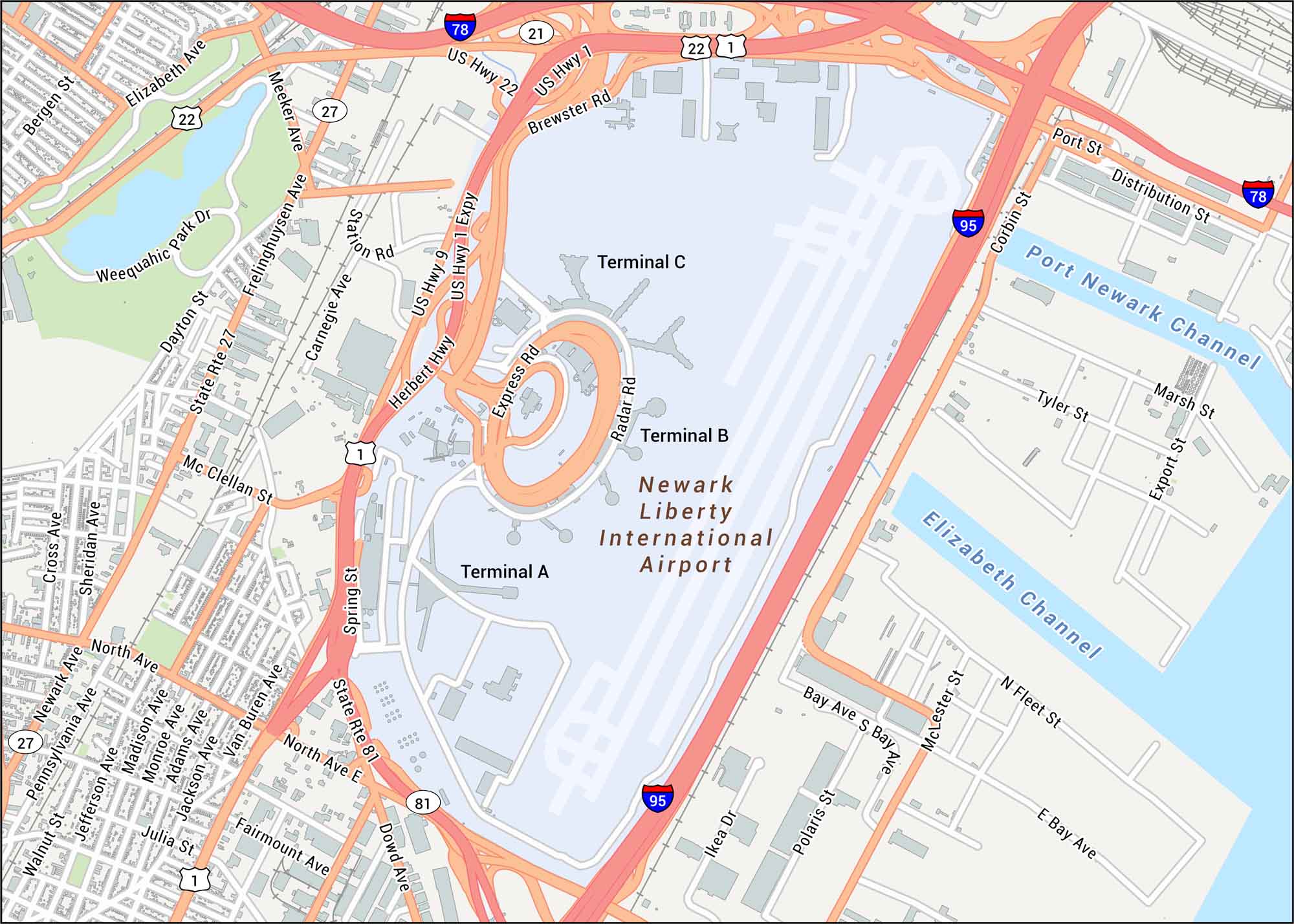
Find your bearings in Newark Airport with its roads, runways, and terminals. The airport is just outside New York City, right by the New Jersey Turnpike. Our road map helps you find your way to this flight hub location.
Map Information
On the Map
Interstates/Highways: I-78, I-95, US Hwy 1, US Hwy 9, US Hwy 22, State Rte 81, State Rte 27 Major Roads: North Ave, Frelinghuysen Ave, Elizabeth Ave, Spring St, Brewster Rd, Express Rd, Radar Rd, Corbin St, Port St, Distribution St, Meeker Ave, Dayton St, Mc Clellan St, Van Buren Ave, Carnegie Ave, Station Rd, Weequahic Park Dr, Bay Ave, McLester St, North Ave E Rivers/Channels: Port Newark Channel, Elizabeth Channel Other Landmarks: Newark Liberty International Airport, Terminal A, Terminal B, Terminal CTourist Maps in New Jersey
Discover all the prime locations with our tourist maps.
No posts