Nashville International Airport Map
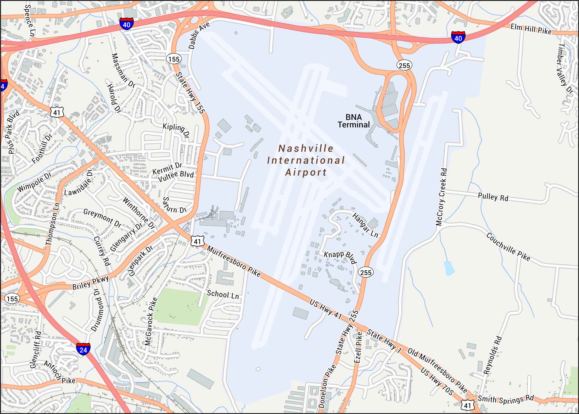
Nashville International Airport is laid out with its runways, BNA terminal and nearby interchanges. Our map highlights every major route and surrounding area. The airport serves Music City, set in the rolling hills of central Tennessee.
Map Information
On the Map
Interstates/Highways: I-40, I-24, US Hwy 41, US Hwy 70S, Briley Pkwy, State Hwy 155, State Hwy 255 Major Roads: Murfreesboro Pike, Donelson Pike, Old Murfreesboro Pike, Elm Hill Pike, Couchville Pike, McCrory Creek Rd, Pulley Rd, Smith Springs Rd, McGavock Pike, Thompson Ln, Massman Dr, Vultee Blvd, Kermit Dr, Saturn Dr, Hangar Ln, Knapp Blvd, Ezell Pike Other Landmarks: BNA TerminalTourist Maps in Tennessee
Discover all the prime locations with our tourist maps.
No posts