Map of Cutler Bay, Florida
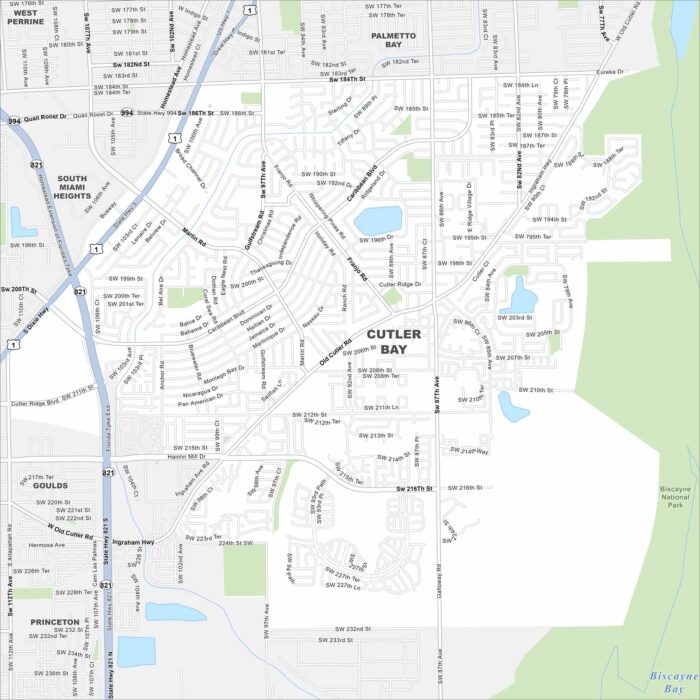
Our map of Cutler Bay outlines its streets, highways, and coastal waterways. South of Miami, the town sits close to Biscayne Bay.
Our map of Cutler Bay outlines its streets, highways, and coastal waterways. South of Miami, the town sits close to Biscayne Bay.
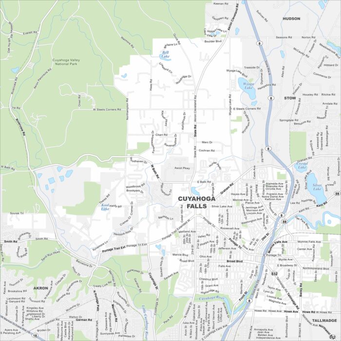
See the mapped streets, highways, and river crossings in Cuyahoga Falls. This city grew around the Cuyahoga River.
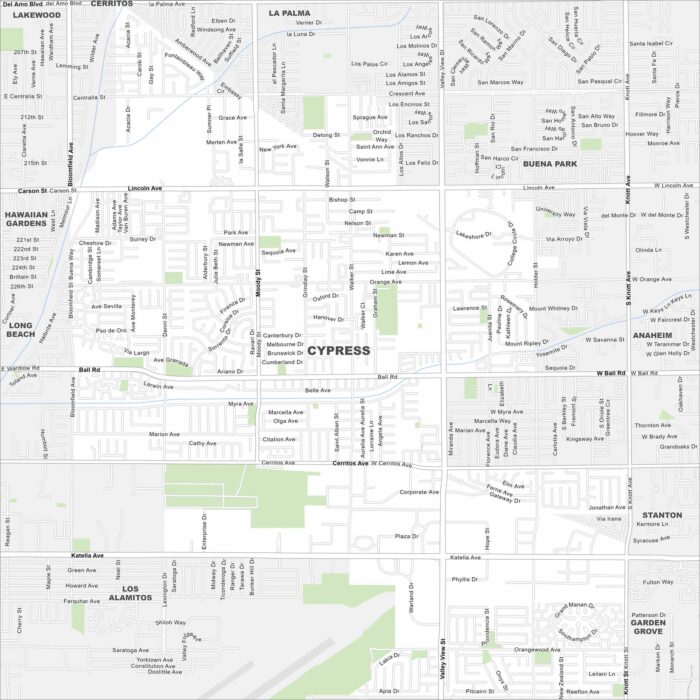
Cypress is shown on our map with its roads, highways, and park spaces. This Orange County suburb lies between Long Beach and Anaheim.
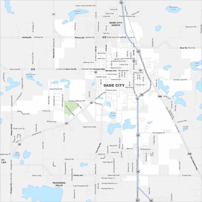
Check out Dade City with its mapped roads, highways, and rolling hills. Situated northeast of Tampa, it’s known for its historic downtown.
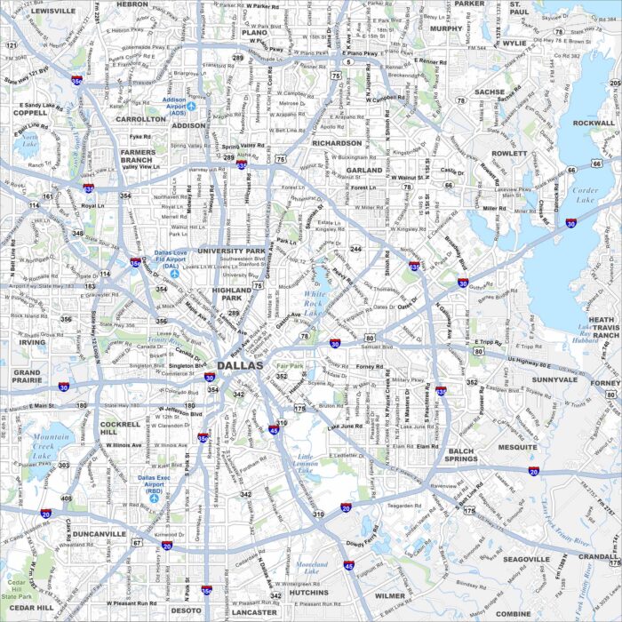
Our map of Dallas highlights highways, streets, and the Trinity River. As a center for business and culture, this city anchors North Texas.
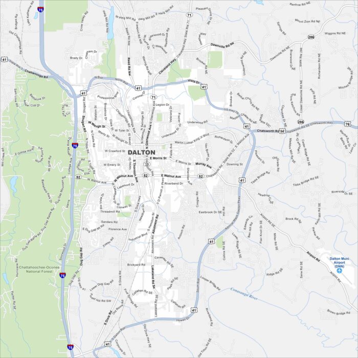
Nestled in the foothills of the Appalachians, Dalton sits next to the Chattahoochee-Oconee National Forest.
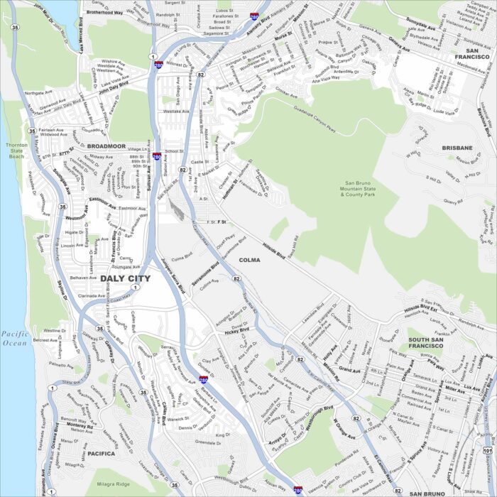
Look at our map of Daly City with its network of roads, highways, and coastal access. Fog from the ocean often blankets the area.
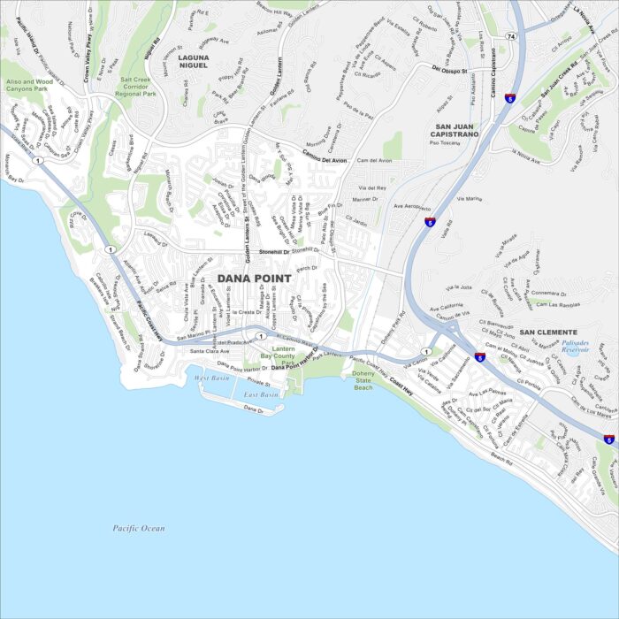
Our map of Dana Point shows its streets, highways, and shoreline. The city is perched on the Pacific Ocean.
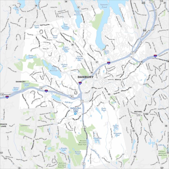
Danbury spreads along the Still River, with I-84 cutting through the heart of the city. Rolling hills are a big part of the landscape here.
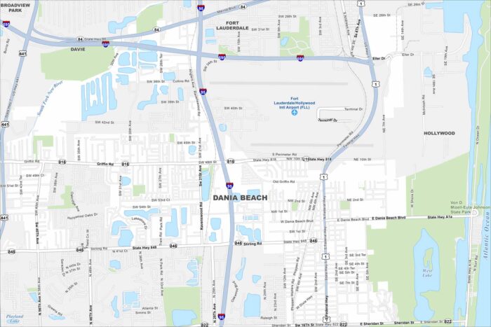
Dania Beach hugs the Intracoastal Waterway and the Atlantic coast. Its streets lead from beachside resorts inland toward residential areas.
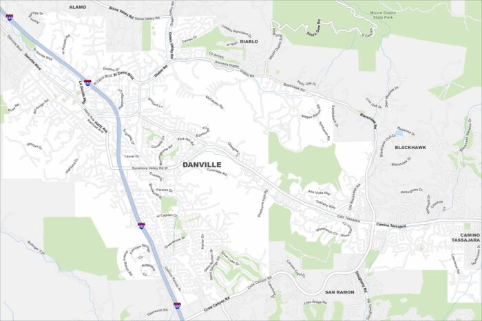
See Danville’s roads, highways, and open green spaces on our map. Tucked in the San Ramon Valley, it’s close to Mount Diablo.
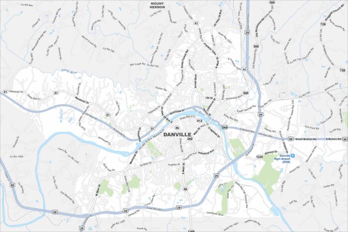
Our map of Danville shows the streets, highways, and the Dan River cutting through. The city grew as a tobacco and textile hub.
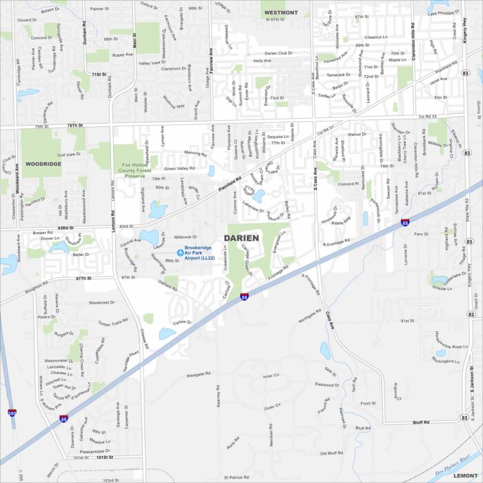
Darien is a southwest suburb of Chicago. Our map of Darien shows its waterways, parks and highways like Interstate 55.
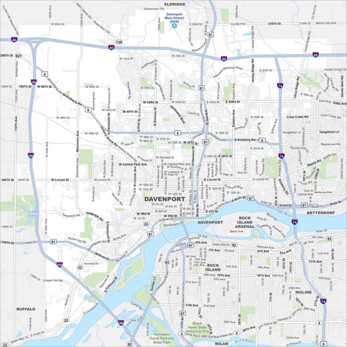
Look over Davenport with its mapped streets, highways, and the Mississippi River on its edge. The city is part of the Quad Cities.
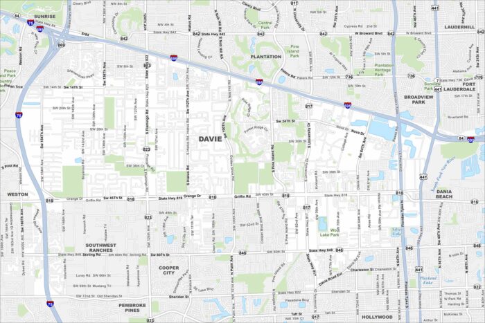
Our map of Davie highlights local roads, highways, and parks. It sits inland from Fort Lauderdale with the Everglades spread out to the west.