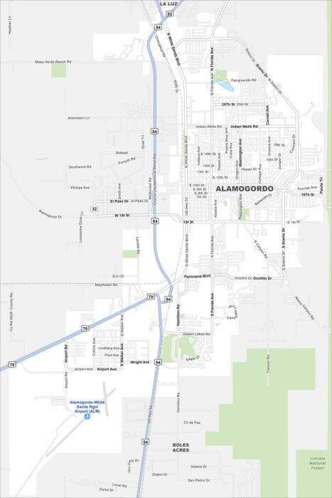
Map of Alamogordo, New Mexico
Alamogordo is a desert city next to the Sacramento Mountains. Our map shows its streets traveling out under wide skies.
Alamogordo is a desert city next to the Sacramento Mountains. Our map shows its streets traveling out under wide skies.
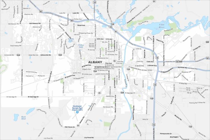
Roadways cross through Albany along the Flint River. Green spaces are also scattered around. Our map shows this South Georgia city.
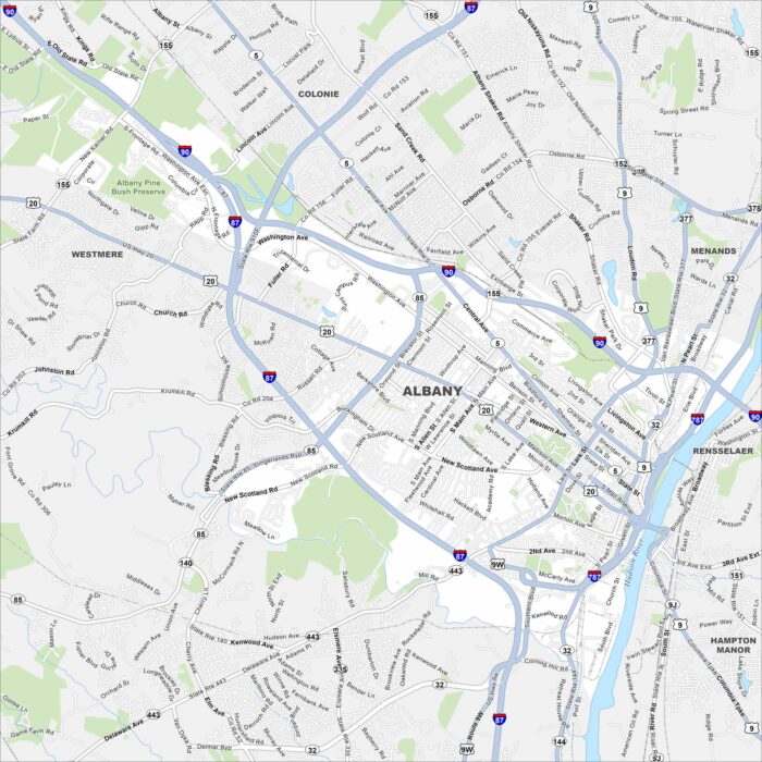
Our map of Albany lays out this historic city on the Hudson River. As New York’s capital, it’s known for its government buildings.
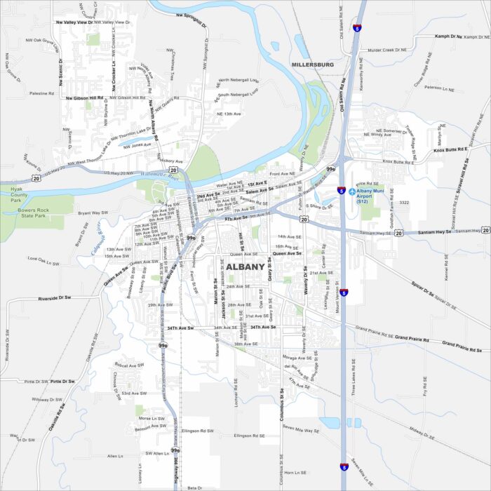
Our map of Albany shows how the city spreads across the Willamette River. Bridges link neighborhoods on both sides of the bank.
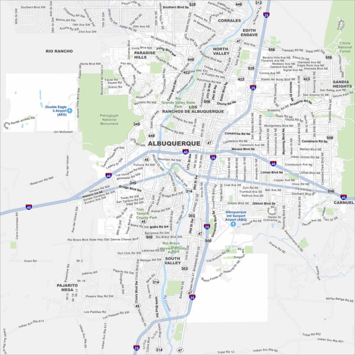
Albuquerque is a desert city in New Mexico. Highways stretch across mesas and the Rio Grande cuts right through the middle.
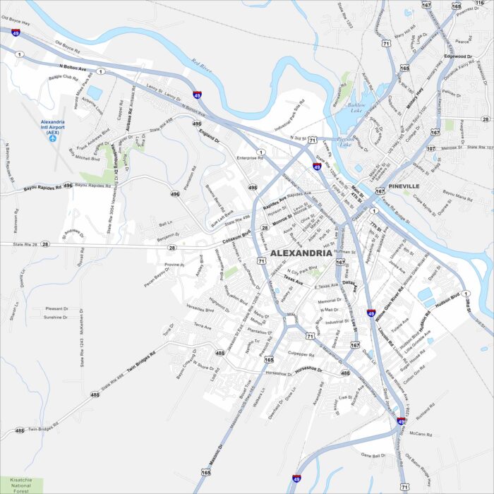
Alexandria sits along the Red River, with roads and bridges tying the city together. Our map shows how it truly is a crossroads of Louisiana.
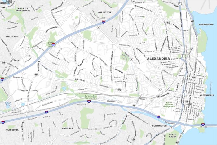
Cobblestone streets make way for a busy waterfront in Alexandria. Our map displays its neighborhoods along the Potomac.
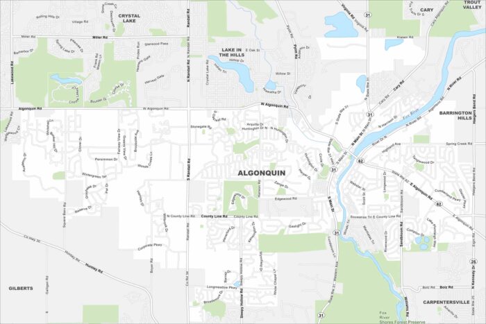
Set along the Fox River, Algonquin has tons of winding roads and open green spaces. Our map shows waterways, highways and local parks.
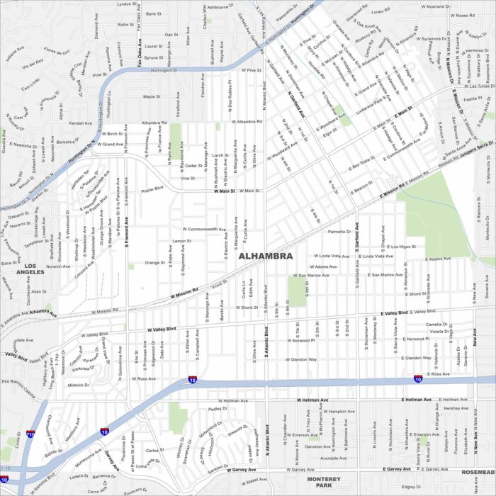
Our map of Alhambra lays out its streets and waterways. This city is next to Los Angeles and is a gateway to the San Gabriel Valley.
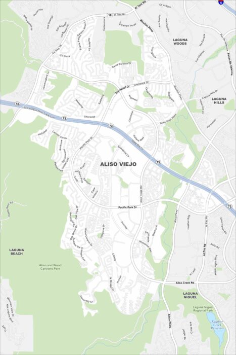
Aliso Viejo is a master-planned city in the hills of southern Orange County. Our map shows how its streets curve around canyons and parks.
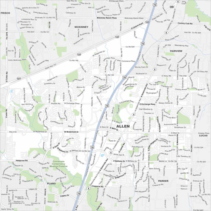
Highways, shopping centers, and wide suburban roads are important to Allen. Our map shows its position in the north Dallas metro.
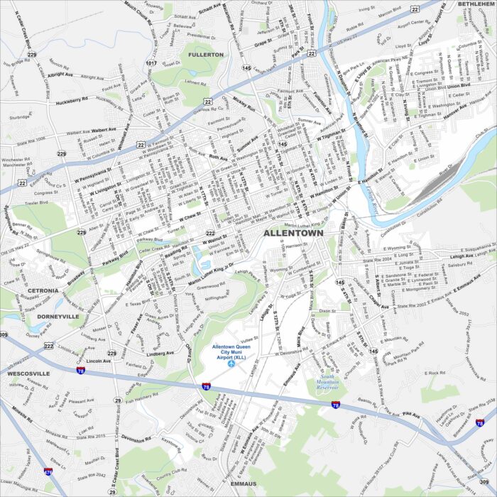
Our map of Allentown shows how the city stretches along the Lehigh River. Meanwhile, highways cut through old industrial corridors.
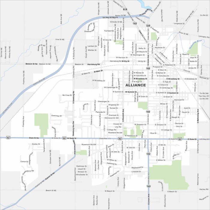
Alliance is a small city with streets that spread across Stark County farmland. Our map highlights its roads and neighborhoods.
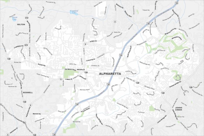
Our map of Alpharetta shows this fast-growing suburb north of Atlanta. Alpharetta has winding neighborhoods with major highways.
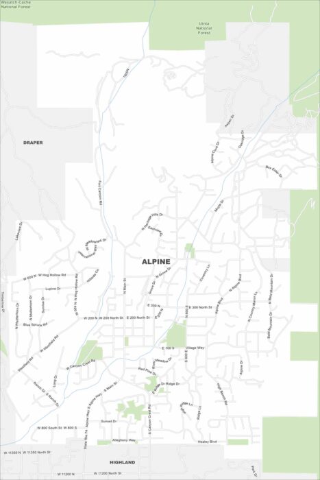
The name says it all. Alpine sits right against the Wasatch Range. This is where suburban roads meet rugged canyon trails.